An estuary is a partially enclosed coastal water body where fresh water running off the land mixes with salt water from the ocean, producing brackish water in between. The mixing is not instant or complete. Fresh water is lighter, so it spreads across the surface while the denser salt water slides underneath, and the boundary between them only breaks down where tides, wind, and river flow supply enough turbulence.
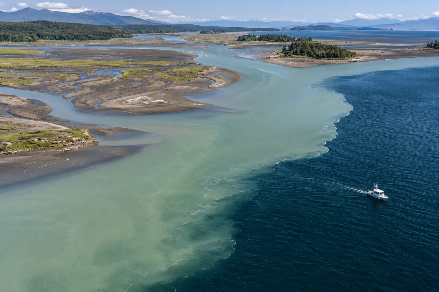
That boundary is the interesting part. Walk down any river at low tide and you can often see the line where the water turns green, then watch it move up and down with the tide over the next few hours. Understanding that line explains why estuaries behave the way they do, and it is also what tells you where to put a sensor, a hull, or a net.
Table of Contents
- What Happens Inside an Estuary?
- Why Freshwater and Saltwater Do Not Simply Meet
- What Controls Salinity in an Estuary?
- How Do Tides Drive Estuarine Mixing?
- How Does River Flow Affect the Fresh-Salt Balance?
- What Role Do Wind, Waves, and Sediment Play?
- Strongly Mixed, Partially Mixed, and Stratified Estuaries
- How Scientists Measure Estuarine Mixing
- Why Estuarine Mixing Matters
- Frequently Asked Questions
- Conclusion
What Happens Inside an Estuary?
Inside an estuary, river water and seawater overlap in a zone that is neither one nor the other. Near the mouth the water is nearly seawater, and further upstream it thins out toward pure freshwater. In between it is brackish, somewhere between roughly 0.5 and 35 parts per thousand.
Pritchard’s 1967 definition, still the standard one, describes an estuary as a partially enclosed body of water that has a free connection to the open sea and within which seawater is measurably diluted with fresh water derived from land drainage. The dilution is the whole point. An estuary is defined by mixing, not by a fixed salinity.
How Estuaries Mix Fresh and Salt Water
Six processes do the work, and they operate on very different timescales.
- River flow. Discharge pushes fresh water seaward and lays it over the denser salt water as a buoyant surface layer.
- Tides. Flood and ebb currents reverse twice a day, dragging salt water inland and then back out. The shear between that moving water and the slower river water generates most of the turbulence.
- Wind. Surface drag stirs the top few metres and can deepen, shoal, or temporarily break down the boundary.
- Waves. At the mouth, waves and breaking surf drive mixing that propagates a short way inland.
- Density differences. Because salt water is heavier, gravity sets up a two-layer exchange flow: fresher water out on top, saltier water in underneath.
- Sediment. Suspended mud raises the density of the upper layer further, which can stabilise the boundary and concentrate the two waters into a narrow band.
Two of these deserve separating, because the distinction explains why mixing is slower than people expect. Stirring means arranging the water so that fresh and salt sit next to each other in gradients, which increases the variance between them. Mixing means actually destroying that variance until the salinity is uniform. Tides and wind do a lot of stirring. Diffusion does the mixing, and molecular diffusion through water is glacial.
Why Freshwater and Saltwater Do Not Simply Meet
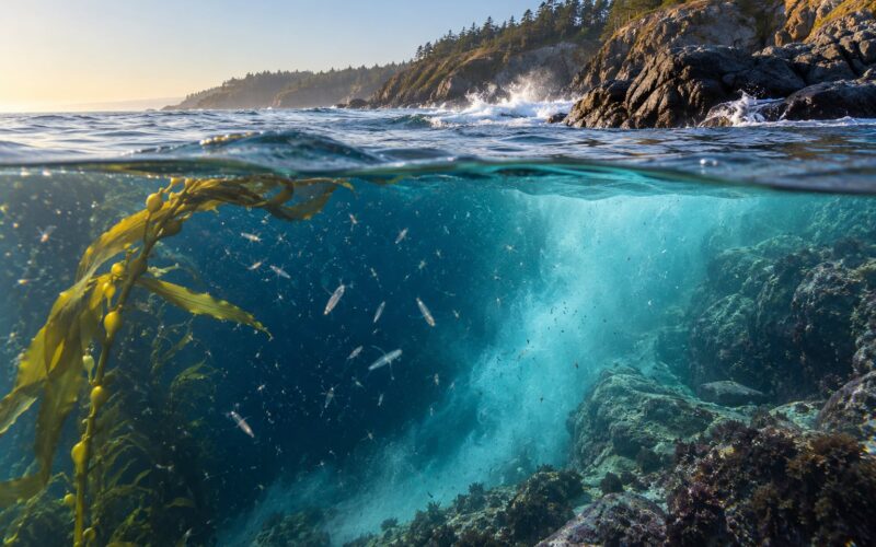
Take a cross-section through a typical estuary and you will usually see three layers: a thin fresher layer on top, a saltier layer underneath, and between them a sharp transition. That transition is the halocline, from the Greek hals (salt) and klinein (to slope). A halocline often produces a pycnocline, a layer of sharp density change, and in summer a thermocline from temperature can sit in the same place.
Nothing is blocking the two waters. Salt diffuses into fresh water and fresh water diffuses into salt water at every boundary, all the time. The process is just so slow that a visible interface can persist for hours or days. The sharp line you see in a photograph, or from a boat, is an optical effect: the two waters have slightly different refractive indices, so the light bending at the boundary makes it look like a surface.
You can watch this at home. Fill a tall clear glass half with salt water, then pour fresh water slowly down the back of a spoon held at the waterline. The fresh water spreads out on top, and if you hold the spoon in place the boundary sharpens instead of blurring. Nothing is there except the water and the light.
What Controls Salinity in an Estuary?
Salinity in an estuary is set by a small number of variables pushing in opposite directions. Knowing which one is dominant tells you what kind of estuary you are looking at.
| Control | Effect on salinity | Notes |
|---|---|---|
| River discharge | More flow pushes the salt front seaward and makes the estuary fresher | The single biggest control in most small systems |
| Tidal range | Strong tides pump salt inland and hold the water column mixed | Large range means weaker stratification |
| Evaporation | Removes fresh water and raises salinity | Drives inverse and hypersaline lagoons |
| Precipitation on the catchment | Floods the system with fresh water and drops salinity sharply | Direct runoff plus a lagging groundwater response |
| Channel and mouth geometry | Shape sets how far the tide reaches and how long mixing takes | Narrow inlets restrict exchange; deep channels retain stratification |
| Storms and cold fronts | Break stratification for a day or two, then let it rebuild | Often the largest short-term salinity swing of the year |
| Upstream water management | Dams, diversions, and abstraction reduce freshwater inflow | Moves the salt front upstream |
A rough rule helps when you have no measurements. If the tide is strong relative to the river, the estuary stays mixed. If the river is strong relative to the tide, it stays layered. Oceanographers put a number on this with the Simpson number, which compares the buoyant energy available to stir the water against the energy needed to mix it.
How Do Tides Drive Estuarine Mixing?
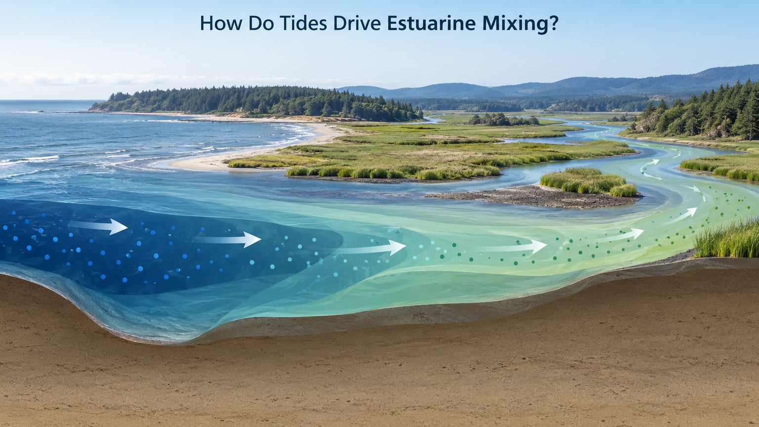
On the flood tide, salt water is pushed up the channel against the river’s own flow. Because that water is denser, it stays low in the channel and creeps upstream along the bed, sometimes tens of kilometres. Near slack water, when the current drops to almost nothing, the shear weakens and the two layers separate cleanly.
Then the ebb starts. Now the whole column moves seaward, and the fresher surface layer rides on top of it. The fresh water that went in during the flood comes back out during the ebb, so the estuary exports surface water and imports salt water underneath in a single exchange. This is estuarine circulation, and it is the reason nutrients and sediment get concentrated rather than simply flushed out.
Salinity does not track the tide instantly, and that lag matters more than most people expect. Salt water takes hours to work its way up the channel, so the salinity at a fixed point keeps rising after high water and keeps falling after low water. Anyone sampling on a fixed schedule, without recording the tide stage, will draw conclusions that the estuary never actually supported.
How Does River Flow Affect the Fresh-Salt Balance?
River flow sets the baseline. A wet winter raises discharge, pushes the salt front seaward, and makes the whole estuary fresher. A dry summer does the opposite, drawing the salt front upstream and pushing the brackish zone further inland than anyone planned for.
During a flood the change can be dramatic and fast. A single storm pulse can drop salinity at a fixed station by many parts per thousand in a day, then let it recover over the following week as the freshwater reservoir drains. Floods also tend to remix the column, because the extra discharge increases shear along the bed and weakens the density-driven layering.
The upstream limit of salt water is a moving target for exactly this reason. The line where salinity drops below 0.5 ppt might sit 5 km inland in a dry month and 30 km inland after a wet spring. Coastal planners who treat that line as a fixed boundary get caught out.
What Role Do Wind, Waves, and Sediment Play?
Wind works on the surface. Sustained wind drags the top layer, deepens the mixed layer, and pushes the halocline down; a shift in direction can shoal it back up. In a shallow estuary a few days of strong onshore wind can hold the entire column well mixed, and the halocline may disappear entirely until the wind drops.
Waves do their work near the mouth, where surf and breaking shoal waves stir the water over the bar and drive a mixing zone that moves upstream as tide range grows. Wave influence falls off quickly with distance from the sea, which is one reason estuaries far from the mouth behave so differently from the ones right next to it.
Sediment complicates it. Suspended mud adds weight to the upper layer, sharpening the density contrast with the saltier water below and making the column more resistant to overturning. Where the river’s sediment load meets the salt front, the two waters are compressed into a narrow zone and the turbidity spikes. That turbidity maximum is a reliable landmark in many estuaries, and it moves upstream and downstream with discharge.
Strongly Mixed, Partially Mixed, and Stratified Estuaries
These labels describe the vertical structure of the water column, not the estuary as a whole. Most real systems sit somewhere between the textbook cases, and the same estuary can change category between a wet month and a dry one.
| Mixing regime | Salinity structure | Typical setting | Response to floods and droughts |
|---|---|---|---|
| Well mixed (or highly mixed) | Nearly uniform from surface to bed, with a small surface-to-bed difference | Strong tides, shallow basins, large tidal ranges | Small salinity change; floods mostly raise the whole estuary uniformly |
| Partially mixed | Noticeable surface-to-bed gradient, strongest around mid-tide | Moderate tidal range and moderate discharge, the most common case | Gradient steepens in floods and weakens during drought |
| Salt wedge (or highly stratified) | Sharp halocline near the bed, salt water occupying the lower channel and moving upriver on the flood | Weak tides and low discharge, common in micro-tidal and Mediterranean systems | Floods push the wedge seaward fast; drought lets it creep upstream |
| Intermittent or intermittently closed | Salinity varies from closed and fresh to open and salty over days to weeks | Bars and spits that seal the mouth during low flow | Salinity can fall to zero in the lagoon, then return abruptly when the mouth reopens |
Large tidal ranges and shallow geometry favour mixing; small tidal ranges and deep channels with strong river flow favour stratification. That is why a San Francisco Bay channel stays mixed while a shallow Mediterranean inlet can hold a salt wedge through an entire dry summer.
How Scientists Measure Estuarine Mixing
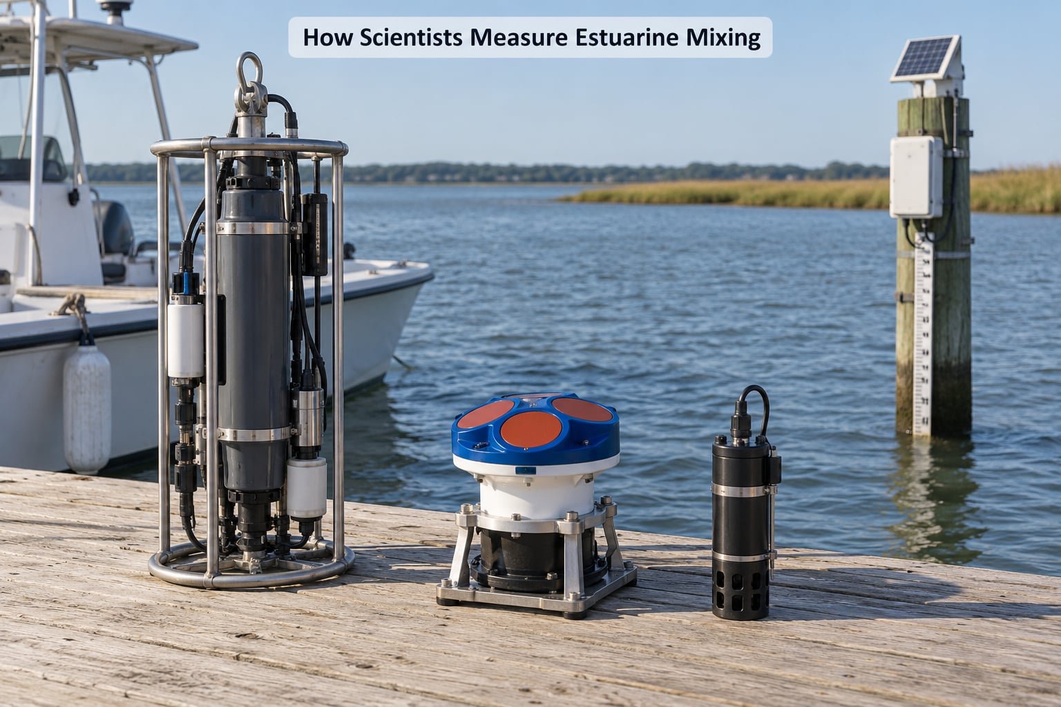
Each instrument answers a different question, so a serious study combines several of them.
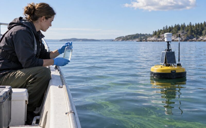
Salinity loggers are the workhorse. A conductivity sensor paired with a temperature sensor gives salinity continuously, typically at fixed depths, and is what reveals the twice-daily tidal swing and the slower seasonal trend. They are cheap, they log for months, and they tell you very little about currents.
CTD casts from a small boat give the vertical structure: salinity, temperature, and density from the surface to the bed in minutes. That is how a halocline’s depth and strength get measured on a transect.
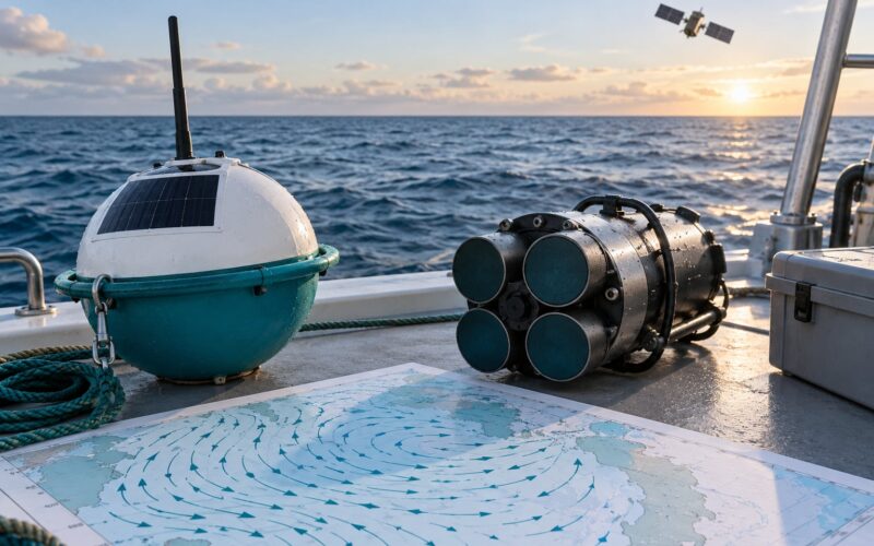
ADCPs, acoustic Doppler current profilers, measure current speed and direction through the water column without any moving parts in the water. Mounted on a hull or a fixed frame, they capture the flood and ebb reversal that drives everything described above.
Tide gauges give the forcing. Salinity data without tide stage is ambiguous, because you cannot tell a low reading caused by river flow from one caused by the tide.
Repeat transects and tracer studies cover the slow timescales. Running the same line every week through a season maps how the salt front moves; releasing a conservative tracer and watching it spread measures the actual mixing rate rather than inferring it. Remote sensing, particularly thermal and salinity retrievals from satellites, covers the estuary at once but only near the surface.
If you are building something yourself, the practical lesson is that a single depth rarely tells the story. In a stratified estuary a sensor at one metre can read freshwater while the sensor two metres below reads near-seawater, and both readings are correct.
Why Estuarine Mixing Matters
The physics has consequences well beyond the water itself.
Sediment and oxygen. Where fresh and salt water meet, suspended sediment flocculates and drops out, building bars and shoals. The same convergence traps organic matter, and its breakdown consumes oxygen, which is why estuaries frequently have a hypoxic zone in deeper water during warm months. Bottom waters that are cut off from the surface by a strong halocline lose their oxygen faster than they can resupply it.
Nutrients and productivity. River water brings nitrogen and phosphorus, seawater brings plankton and organic carbon, and the mixing zone concentrates both. That nutrient trapping is why estuaries support shellfish farming, seagrass, salt marsh, and oyster reefs, and why they are nursery habitat for species such as striped bass, Atlantic menhaden, and American shad that return from the ocean to spawn. Migratory ducks such as mallards and canvasbacks use the same marshes as stopover habitat.
Flooding, pollution, and resilience. Because estuaries funnel water, they buffer storm surge inland, and they dilute and trap land-based pollution before it reaches the open sea. They are also where sea level rise meets river sediment supply, and where changes to one upstream affect everything downstream.
Equipment. Brackish water is corrosive in ways that neither pure fresh water nor open ocean is. Salinity swings shift galvanic corrosion currents twice a day, and biofouling attaches faster in nutrient-rich water than in open sea. For anyone running a hull, a mooring, or an electronics pod in an estuary, salinity is a variable to design around rather than a number to look up once. Our guides to marine sensors and hull materials cover that side of it in more detail.
Freshwater estuaries show the contrast. Where the Great Lakes meet the St Lawrence, lake water mixes with river water in tidal marshes without any seawater involved at all, and the mixing physics is the same.
Frequently Asked Questions
Do fresh water and salt water mix completely in an estuary?
They mix, but not completely and not quickly. Salt does diffuse across the boundary, yet molecular diffusion through water is far too slow to homogenise an estuary on its own. Tides, wind, waves, and river flow supply the turbulence that does most of the work, and even then a salinity gradient usually remains from the mouth to the river head.
Where does the mixing of fresh and salt water usually occur?
The mixing zone is the overlap between the river’s fresh water and the tidal salt water, and it moves along the estuary rather than sitting in one place. It sits furthest inland during low river flow and retreats towards the mouth after heavy rain. In many systems the strongest vertical mixing happens around mid-tide, where currents are fastest.
What makes an estuary’s water saltier or fresher?
River discharge and tidal range are the two dominant controls. More river flow pushes salt water seaward and makes the estuary fresher; a stronger tide pumps salt further inland. Evaporation and low rainfall raise salinity, while storms and floods drop it sharply and temporarily. Upstream dams, diversions, and abstraction change all of this.
Why is salt water often found below fresh water?
Dissolved salt makes seawater denser than fresh water, so it sinks and spreads along the bed while the lighter fresh water rides over the top. That creates a halocline, a layer of sharp salinity change, often with a matching pycnocline in density. The visible line at that boundary is an optical effect of differing refractive index, not a physical wall.
How does human activity change estuarine mixing?
Dams, water diversion, and abstraction all reduce the freshwater inflow that pushes salt water seaward, so the salt front moves upstream and the estuary becomes saltier over time. Land clearance raises nutrient and sediment loads, feeding algal blooms and low-oxygen zones. Sea level rise pushes salt water further inland, and coastal engineering changes how far tides reach.
Conclusion
Estuarine mixing is a balance, not a blend. Fresh water arrives from the land, salt water arrives with the tide, and the two only combine where currents, wind, and density work together. The resulting gradient shifts twice a day, again each season, and again with every flood.
Start by observing it. Pick a station in your river or creek, note the tide stage, and take readings near the surface and near the bed at flood, mid, and ebb tide. Two depths and a few tide stages will show you more about how your estuary mixes than a single number ever could, and that understanding is what makes the difference between equipment that survives brackish water and equipment that does not.