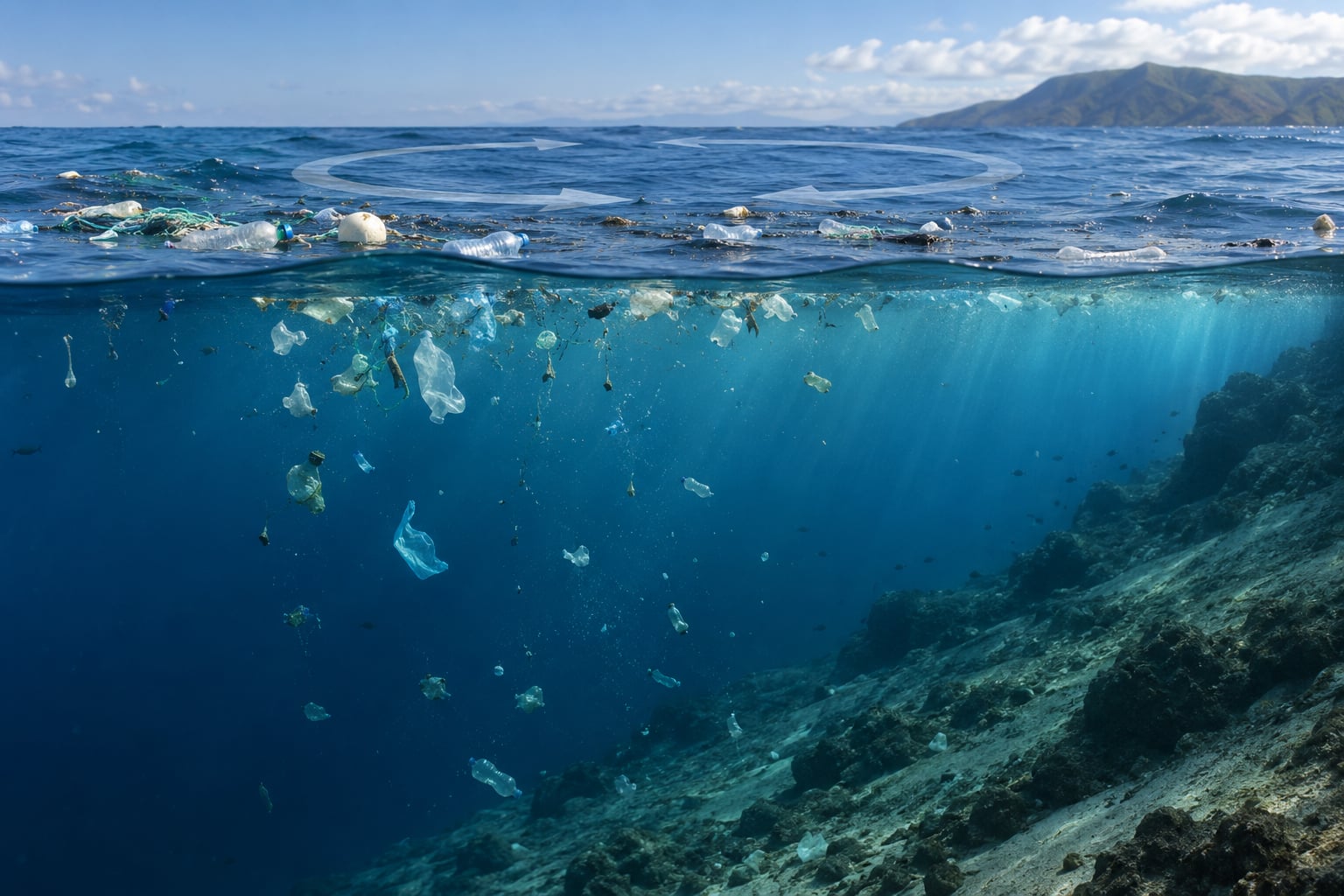
Ocean currents move debris the same way they move water: anything suspended in seawater is dragged along by the flow. Floating plastic rides the wind-driven surface layer, denser material is carried by deep density-driven circulation, and where those flows converge and rotate, debris gathers into the loose, soupy accumulation zones people call garbage patches.
That is the short answer. The interesting part is that the water is rarely the only thing pushing an item around, and the difference between a bottle cap that stays on the surface for years and one that disappears to the seafloor is decided by a handful of measurable physical properties.
Table of Contents
- Key takeaways
- What forces make ocean currents move?
- How do ocean currents move debris?
- What determines where a piece of debris goes?
- Why do currents concentrate debris in gyres?
- Why does debris end up on coastlines and beaches?
- Can ocean currents mix debris back into the water column?
- How do scientists track debris with currents?
- What does this mean for cleanup and marine sensing?
- Frequently Asked Questions
- Does ocean current movement always carry floating debris in the direction of the wind?
- How long does it take for a plastic bottle to reach a beach?
- Are garbage patches solid islands that boats can easily collect?
- Can ocean drones track and remove plastic debris effectively?
- Why can some debris remain on the seafloor instead of returning to the surface?
- Conclusion
Key takeaways
- Debris moves by advection: the moving water carries it, and how well it keeps up depends on buoyancy, shape, size and how much of the item sits above the waterline.
- Wind matters as much as current. Surface current flows average out to about 3 to 45 degrees to the right of the wind in the Northern Hemisphere, because the surface layer and the geostrophic flow beneath it turn at different rates.
- Waves push floating debris in a second direction entirely, called Stokes drift, so items often sit slightly downwind of the water they are floating in.
- Subtropical gyres concentrate debris over vast areas but never seal it in. Anything that sinks, breaks apart or gets eaten can leave the accumulation zone.
- Estimates suggest roughly 1 percent of plastic litter entering the ocean each year stays afloat, so the surface layer that people picture is a small slice of the total.
One correction before we go further. The garbage patches are not solid floating islands. There is no place to stand, no visible surface from a plane, and nothing to walk on.
What forces make ocean currents move?
Ocean currents are the large-scale movement of seawater driven by a small set of forces: wind stress on the sea surface, the Earth’s rotation, differences in water density, and the shape of the ocean basin itself.
Wind stress drives most of what we see at the surface
Wind drags on the sea surface, transfers momentum into the upper few tens of metres of water, and creates surface currents. The classic example is the trade winds driving the North and South Equatorial Currents westward across the tropical oceans.
Because the friction between air and water is uneven, the surface current does not sit directly under the wind. The Coriolis effect deflects the moving water, and the balance between wind stress and that deflection is what oceanographers call Ekman transport.
The Earth’s rotation bends everything
The Coriolis effect deflects moving objects to the right in the Northern Hemisphere and to the left in the Southern Hemisphere. In the North Pacific that means the North Equatorial Current turns north into the Kuroshio Current and the North Pacific Current bends back east toward North America.
Below the wind-driven layer, pressure balance with the Earth’s rotation sets the speed of the flow instead. That is why the fast, narrow currents sitting under the surface move almost exactly parallel to the lines of constant pressure.
Density differences drive the deep layer
Cold, salty water is denser than warm, fresh water. When dense water sinks in the North Atlantic, it spreads along the seafloor and resurfaces in the Pacific, a slow global overturning often called thermohaline circulation or the ocean conveyor belt.
This deep layer moves far more slowly than the surface and over much longer timescales. It matters for debris because anything that leaves the surface layer eventually enters a circulation that can carry it thousands of kilometres horizontally before it returns to the surface or finally settles out.
Tides and coastal shape add local complications
Tides reverse or shift flow twice a day, and coastal boundaries funnel water into jets and eddies. Rivers add their own outflow, which can carry debris far out to sea before the ocean takes over.
Storms add a third layer: wind and wave energy that can push floating debris toward a coast faster than the ambient circulation ever would.
How do ocean currents move debris?
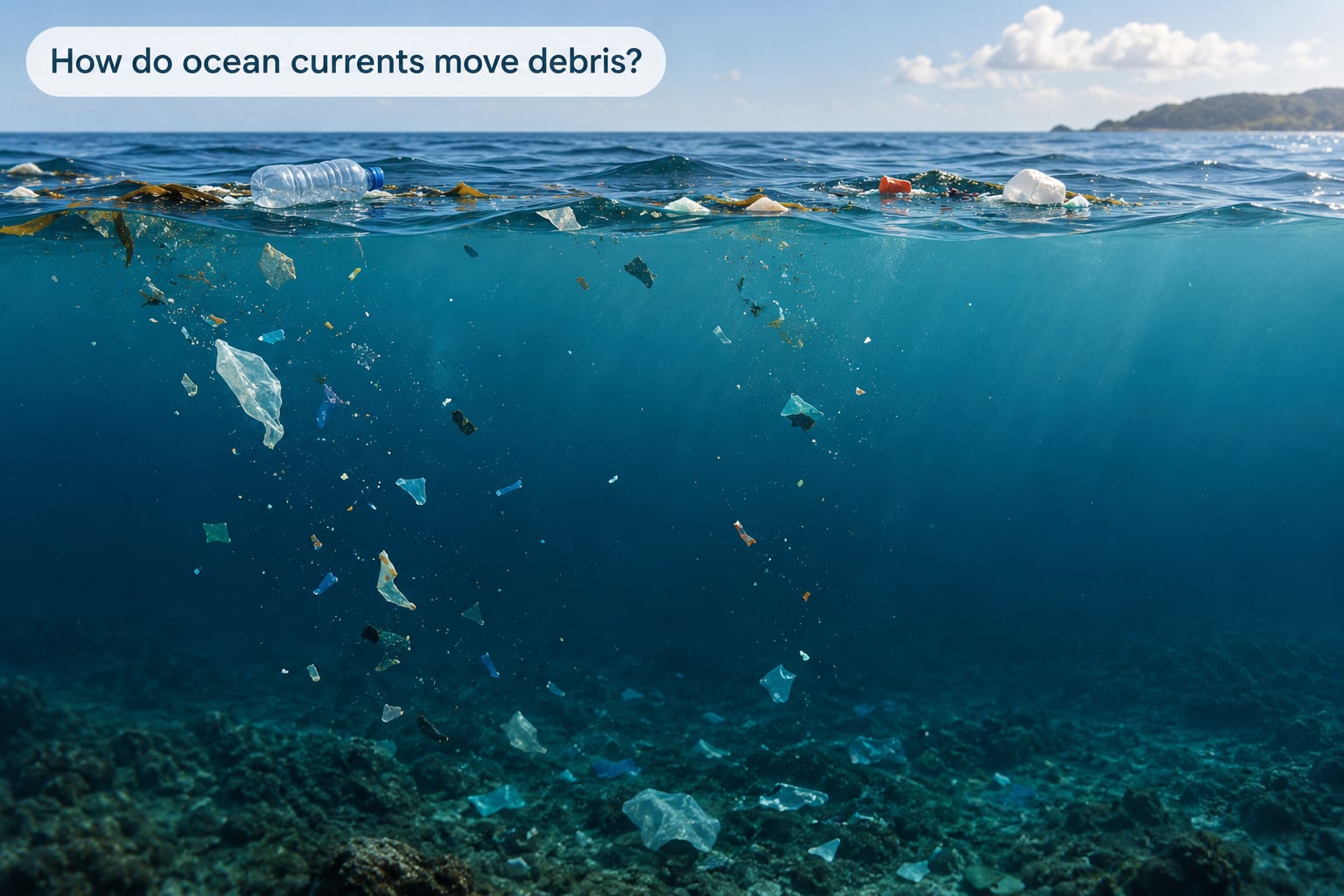
Debris moves through the ocean in a chain of four steps, and each step changes which force does the work.
First, the item enters the water. Rivers, storm drains, fishing gear and shipping are the main sources, and most of this debris starts out suspended in a river plume rather than at sea.
Second, the current picks it up. Anything with a positive buoyancy sits partly above the surface, gets pushed by wind and waves, and drifts through the surface layer until it reaches a convergence zone.
Third, vertical processes redistribute it. Wave action, Langmuir circulation, breaking surf and turbulence mix material down from the surface, and biofouling changes the density of items that start out floating.
Fourth, the circulation either carries it onward, strands it on a coast, or lets it settle to the seabed. Anything small enough to break into fragments during this journey becomes microplastic, which behaves very differently from the parent piece.
The practical point for anyone tracking marine debris is that the pathway is not a single line. The same storm can strand debris on one beach, push it back offshore at the next, and resuspend fragments that had already settled.
What determines where a piece of debris goes?
Once an item is in the water, four properties decide the rest of its journey: how buoyant it is, how much surface area it presents to wind, how fast it settles, and how fragile it is.
How do wind and waves push floating debris?
Wind pushes on whatever part of an object stands above the waterline, and that fraction is called windage. A hollow crate has enormous windage and can travel at close to the wind speed. A flat bottle floats with its face mostly down and barely feels it at all.
Surface currents themselves flow roughly 3 to 45 degrees to the right of the wind in the Northern Hemisphere, and the angle widens toward the pole. That offset is the visible signature of the Ekman spiral in a floating object’s track, and it is the reason a plastic item does not simply follow the wind map printed on most charts.
Waves contribute a second, independent drift called Stokes drift. Orbital water motion in a wave pushes surface water and everything floating on it forward along the direction of wave travel, which means floating debris sits slightly downwind and shoreward of the water mass it is floating in.
Turbulent mixing works against that horizontal drift. Random eddies move a floating item sideways relative to the mean flow, which over months spreads debris into bands and smears out any neat single trajectory.
How do floating, suspended and sinking debris differ?
Density sets the pathway. Seawater has a density of roughly 1,025 kg/m3, and whether an item floats, sinks or stays neutrally suspended depends on how its own density compares with that.
| Debris class | Typical density behaviour | How currents move it | Likely endpoint |
|---|---|---|---|
| Floating (macroplastics) | Less dense than seawater | Wind-driven surface circulation, gyre convergence, storm redistribution | Stranding, sinking after fouling, or breakup at sea |
| Suspended (micro and meso) | Near neutral or repeatedly re-suspended | Mixing, eddies, Langmuir circulation, downward diffusion | Descent into deeper layers and the deep circulation |
| Sinking | Denser than seawater, or fouled past neutral | Vertical settling, aggregate formation, water-mass transport | Seabed deposition, sometimes decades later |
| Seabed-bound | Fully settled | Deep circulation, bottom currents, resuspension in storms | Long-term storage, or remobilisation and re-stranding |
Aggregates deserve special attention. Microplastic particles can stick together with organic material into denser flocs that sink far faster than their loose equivalents, which means the smallest debris can reach the seabed quickly while the largest floats for years.
Biofouling is a reversible switch. Once algae, barnacles and other organisms colonise a floating item, its effective density rises until it sinks. Move it into lightless water and the colonists die off, density drops again, and the item can resurface. That single mechanism sends material down and back up over months to years.
Why do currents concentrate debris in gyres?
A gyre is a basin-scale rotation of surface water, and subtropical gyres form because trade winds push water toward the equator and the western boundary currents carry it back poleward. Debris riding those currents is delivered to the same slow, high-pressure centre from several directions at once.
The convergence is real, but the trap is weak. Net surface drift speed in a gyre centre is low, so debris slows down and lingers. It does not stop, and it is not held in a closed ring.
| Accumulation zone | Bounding surface currents | Debris signature |
|---|---|---|
| North Pacific Subtropical Gyre | North Equatorial, Kuroshio, North Pacific, California currents | Largest and most studied of the five; dominated by fishing gear and larger floating plastic |
| South Pacific Subtropical Gyre | South Equatorial Current and its poleward return | Lower reported concentration than the North Pacific |
| North Atlantic Subtropical Gyre | North Equatorial, Gulf Stream, North Atlantic Drift, Canary currents | Lower density than the Pacific gyres, with a higher share of consumer packaging |
| South Atlantic Subtropical Gyre | South Equatorial Current and its poleward return | Smaller, less intensively sampled |
| Indian Ocean Subtropical Gyre | South Equatorial Current and Agulhas return flow | Receives substantial debris input from densely inhabited river catchments |
The North Pacific zone covers an estimated 1.6 million square kilometres, which is why it attracts both researchers and cleanup operations. Reported concentrations reach up to 890,000 pieces per square kilometre in the most sampled areas.
Scale matters here. Eriksen and colleagues estimated 233,400 tonnes of floating macroplastic and 35,540 tonnes of microplastic afloat in 2014, and Lebreton’s group revised the Great Pacific figure upward in 2018, roughly to 79,000 tonnes and 1.8 trillion pieces. That was about sixteen times the earlier estimate and an uncomfortable number for anyone who had absorbed the older figure.
Debris is also an ecosystem. Helm and colleagues reported from the North Pacific Subtropical Gyre that floating organisms such as the sea raft Velella, the blue button Porpita and violet sea snails of the genus Janthina gather in the same convergence zones as plastic, in a band around the gyre’s outer edge rather than its calm centre.
Why does debris end up on coastlines and beaches?
Most beach debris was not left there by the people who live on that coast. Coastal convergence, downwelling and wave action deliver material from offshore water that can be hundreds of kilometres away.
Where a surface current runs into a coastline and is forced upward, water sinks and the floating material stays behind with it. That process is called downwelling, and it is one of the main ways debris reaches shore rather than continuing past it.
Estuaries add a second delivery mechanism. River outflow pushes water and buoyant debris seaward during the day; on the flood tide the same estuary pulls floating material back inland. Debris that drifts near an estuary mouth often gets carried in and stranded on the tidal flats.
Then there is the surf. Swash carries material up the beach face, and if the next wave does not carry it back down, it stays. Beachcombers and sailors regularly note that the litter on a given coastline has little relationship to local littering, which fits a delivery mechanism that imports material from offshore.
Seasonal wind shifts matter for forecasting. When the prevailing wind changes direction for a season, the surface layer moves with it, and coastline debris accumulations often follow within weeks.
Can ocean currents mix debris back into the water column?
Yes, and often. Debris concentration in an accumulation zone is not a permanent state, because storms, breaking waves and turbulent mixing push material back out as well as in.
Fragments are the easiest to remobilise. A plastic item exposed to sunlight and wave action breaks into smaller and smaller pieces, and the smaller the piece, the faster it mixes downward through the surface layer.
Microplastics are also the hardest to trace. They are individually untrackable, they stay suspended for long periods, and they can be carried into the deep circulation or settle into sediment without anyone noticing. Kane and colleagues reported seafloor concentrations reaching as high as 1.9 million pieces per square metre in some hotspots, in sediment that makes up the majority of marine litter in the deep ocean.
That is the asymmetry worth remembering. Recovery operations work on material that is large, visible and at a known depth. Everything smaller than that is effectively outside their reach for now.
How do scientists track debris with currents?
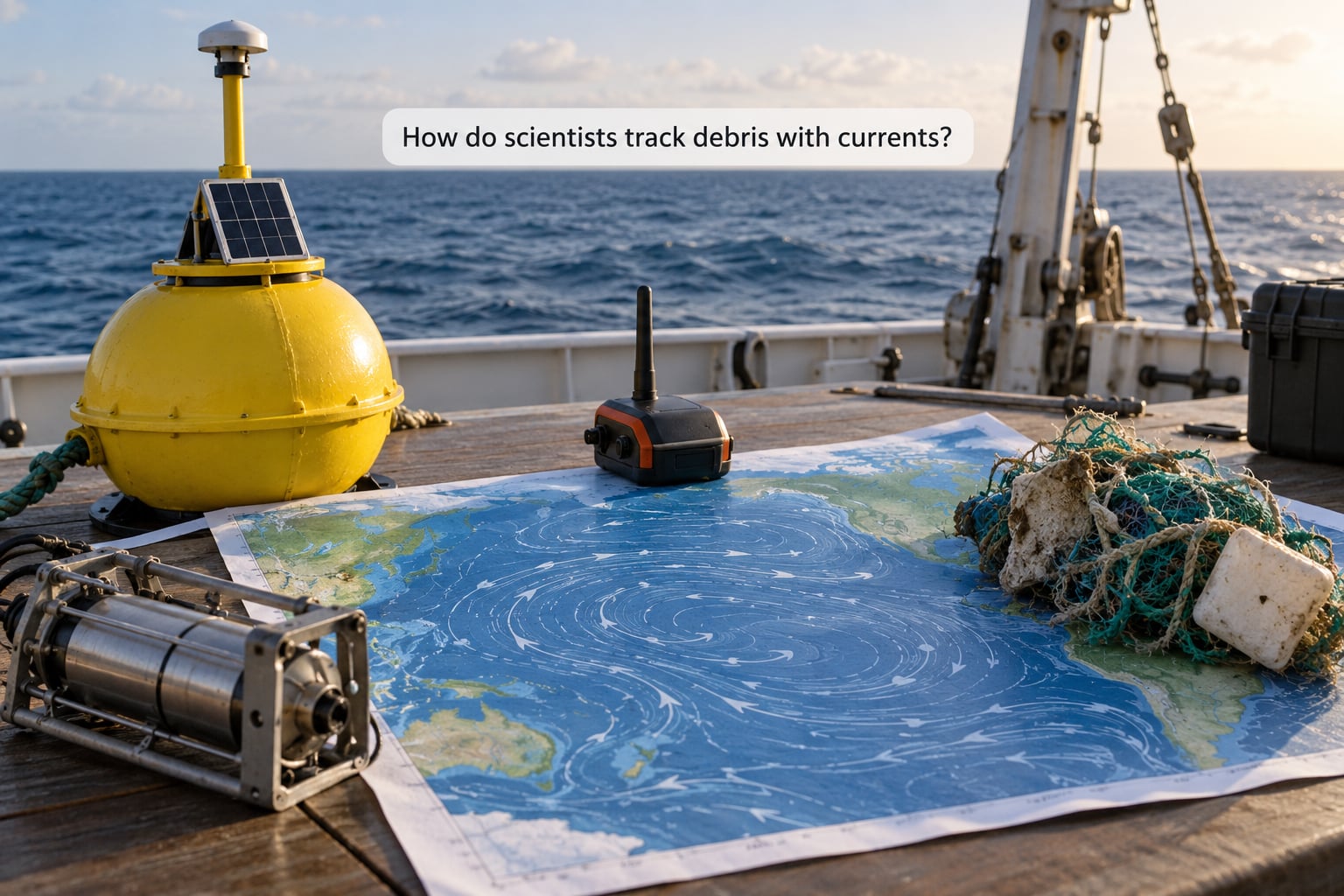
Tracking debris means tracking water, because debris moves with it. Researchers combine instrument measurements, modelled surface currents and physical sampling, and each method has a specific blind spot.
| Method | What it gives you | Where it falls short |
|---|---|---|
| Surface drifters and drifter bottles | Direct Lagrangian trajectories that current velocity alone does not provide | Only a few percent reach the intended convergence zone |
| Modelled surface currents | Basin-scale predicted trajectories and convergence zones | Predictions, not measurements; resolution is coarse near coasts |
| Satellite altimetry | Sea-surface height anomaly, which maps the current field itself | Sea surface only; tells you where the water goes, not what is in it |
| Surface beacons on tagged debris | Real trajectories for individual large items | Needs power, holds fast on only part of the debris, and is expensive at scale |
| Argo floats and deep circulation models | Subsurface and deep-layer transport pathways | Floats drift with the water they are designed to sample; no debris payload |
| Neuston nets and visual transects | Abundance and size distribution of floating and suspended debris | Snapshot sampling; net size sets a detection floor for microplastics |
Because of the Lagrangian sampling problem, most survey work uses the opposite logic. Instead of releasing an object and hoping it arrives, researchers predict where currents will concentrate material and then go and sample there, which is exactly the approach used to plan community science surveys of the North Pacific gyre.
Modelling has become good enough to route an 80-day open-ocean swim through predicted debris hotspots. That is a useful proof of concept: the same code path that planned a research route can plan an interception.
What does this mean for cleanup and marine sensing?
The physics above turns directly into three decisions, and getting them wrong wastes most of a deployment budget.
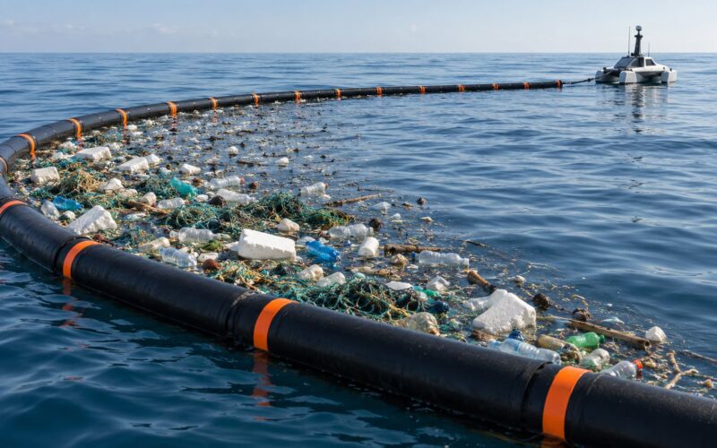
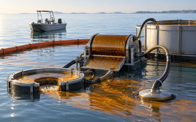
Decide on the target first. A surface interceptor and a seabed-towed system are solving different problems, because buoyant macroplastic and settled microplastic travel through completely different pathways. Targeting the 1 percent that floats is a different operational decision from targeting the 99 percent that does not.
Then find the convergence zone rather than the maximum. Floating debris concentrates where surface flows converge, which is typically the low-wind, high-pressure interior of a gyre, not the visually busiest stretch of current. Placing a sensor or a vessel at the edge of the gyre wastes most of its operating time.
Time around the physics. Wind shifts, storms and seasonal current changes move the target faster than a slow-moving platform can reposition, so sensor siting needs a forecast window rather than a permanent location.
For ocean-drone operations, the hardest constraint is durability in convergence zones. That is where high concentrations of biological growth, abrasion against fishing gear and constant contact with floating debris combine, which is why recoverable design beats one-way deployment for that environment.
Frequently Asked Questions
Does ocean current movement always carry floating debris in the direction of the wind?
No. Surface currents typically flow about 3 to 45 degrees to the right of the wind in the Northern Hemisphere, a deflection that widens toward the pole and comes from the Earth’s rotation. Waves add a separate forward drift, and wind only pushes the part of an item above the waterline. So floating debris usually ends up at an angle to the wind, and often further along than the wind map suggests.
How long does it take for a plastic bottle to reach a beach?
It depends almost entirely on where it enters the water and where the beach is. A bottle carried out of a river plume may spend years circling a subtropical gyre before a storm or seasonal wind shift pushes it onto a coast. Debris already near a coastline can strand within days. There is no fixed timescale, and the dominant term is often the object’s shape rather than its material.
Are garbage patches solid islands that boats can easily collect?
No. There is no solid island anywhere in the ocean. What exists is a spread-out region where floating debris and microplastics are unusually concentrated, mixed through the water column rather than piled on the surface. You cannot stand on it or see it from a plane. Because the material is dilute, spread over a vast area and constantly mixing, collection at any useful scale remains difficult.
Can ocean drones track and remove plastic debris effectively?
Partly. Drones are good at surveying a convergence zone cheaply and at logging exactly where and when debris passes, which is the measurement problem operators struggle with most. Removal is harder, because deployed platforms also sit in the most heavily fouled, most heavily abraded part of the ocean. Most successful operations pair drones for detection with surface vessels for capture.
Why can some debris remain on the seafloor instead of returning to the surface?
Because nothing reliably brings it back up. Once material sinks, it leaves the wind-driven layer that people watch and enters deep circulation where speeds are far slower. Seabed currents can move it long distances horizontally, and storms occasionally resuspend it into the water column, but a piece that settles in a sediment basin can stay there for decades while the roughly 1 percent of litter that stays afloat keeps circulating.
Conclusion
The transport chain runs from source to surface layer, through convergence into an accumulation zone, then onward to stranding, sinking or fragmentation, with deep circulation carrying whatever leaves the top few hundred metres. Wind sets the surface drift, the Earth’s rotation angles it, and density decides whether an item ever stays at the surface at all.
Start with four questions before picking any sensor or cleanup method: what type of debris is the target, at what depth does it sit, which current regime carries it, and where does that regime converge. Get those four right and the rest is a logistics problem. Get them wrong and the equipment is measuring the wrong ocean.