How GPS works at sea is the same physics as on land, because the satellites do not know or care where your receiver is mounted. A receiver aboard the vessel times the arrival of signals broadcast from at least four satellites, converts each travel time into a distance, and solves those distances for latitude, longitude, altitude and time. At sea the physics is the same, but the geometry and the hardware around it are not, and that is where accuracy gets won or lost.
This guide is written for people who have to depend on the answer: marine engineers, ocean researchers, skippers, and anyone building a sailing robot that has to find its way home without a pilot. It walks through the signal chain, the components of a marine system, the arithmetic behind a position fix, the accuracy tiers you can actually buy into, and the failure modes nobody mentions until they happen.
Table of Contents
- How GPS Works at Sea: The Basic Positioning Chain
- What Are the Parts of a Marine GPS System?
- How Does a GPS Receiver Calculate Position?
- Why Does GPS Accuracy Change on the Water?
- How Do Marine Systems Improve a GPS Position?
- Can GPS Be Blocked or Jammed at Sea?
- How Should a Sailing Robot or Ocean Drone Use GPS?
- Frequently Asked Questions
- Conclusion
How GPS Works at Sea: The Basic Positioning Chain
The short version, in five steps:
- Satellites in medium Earth orbit broadcast their own position and the exact time they transmit, continuously, to everything in range.
- The receiver on the vessel records the arrival time of each signal and subtracts the transmission time, giving a flight time.
- Flight time multiplied by the speed of light gives a distance to that satellite, called a pseudorange.
- With distances from four satellites, the receiver intersects four spheres and solves for three position coordinates plus one clock error.
- Repeat the fix once a second and the difference between fixes gives speed over ground and course over ground.
There is no ground station involved in the fix itself, and that matters offshore. A cell-tower-assisted phone fix depends on a network that disappears the moment you pass the breakwater; a satellite fix does not care whether there is any land within 200 miles.
The chain is also the answer to a question that comes up constantly: no, nothing about GPS is sea-specific. The satellites broadcast toward the ocean and the land identically. Every marine difference sits in the receiver, the antenna, the software corrections and the weather between you and the sky.
Speed over ground and course over ground both come from comparing consecutive fixes, which is why a receiver that has just acquired satellites after a long power-down can show a wildly wrong speed until it settles.
What Are the Parts of a Marine GPS System?
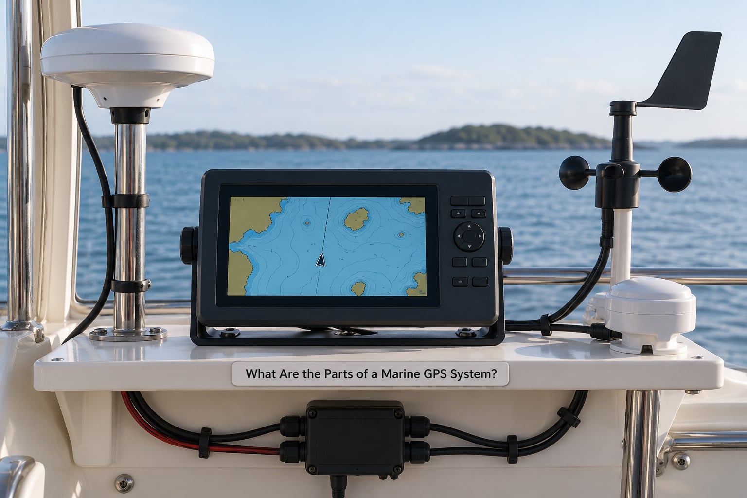
A working marine position system is a chain of six parts, and most failures trace back to one of the first three.
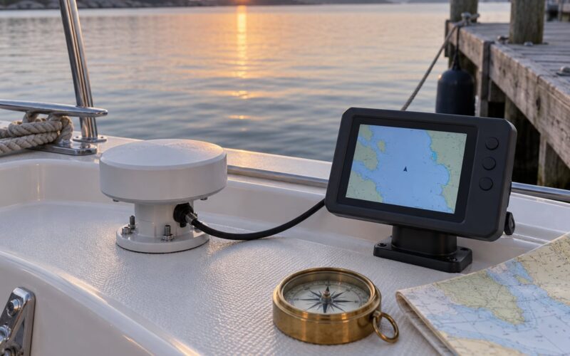
The antenna
A marine GPS antenna is not a phone-style patch puck. It sits on a mast or the cabin top, usually in a weatherproof housing with a ground plane, tuned to the L1 band near 1575 MHz and, on better units, to L2 and L5 as well. Its job is to see as much sky as possible and to reject signals arriving from low angles, which are the ones that bounced off something.
The cable run
Coaxial cable carries the signal from antenna to receiver, and it is the most-neglected component on the boat. Right-angle connectors, a chafe point where the cable passes through a deck gland, and an undersized cable that loses signal over 20 metres will all produce the same symptom: a receiver that works fine alongside and degrades once you are under way.
The receiver
The receiver does the mathematics, tracks satellites, applies corrections and outputs a position. Marine receivers are built to survive vibration, humidity and a wide supply-voltage range, and to boot in seconds rather than minutes. That quick-acquire behaviour matters more offshore than most people expect, because a cold start in an anchorage where the crew is trying to enter at night is a bad moment for a two-minute lock.
Power
Anything on a bridge that browns out can reset a receiver to factory defaults, which on some units means the wrong time zone and date until someone fixes it. A dedicated supply with adequate fusing is the boring answer, and boring is right.
The display or controller
A chartplotter or a small dedicated display takes the NMEA sentences from the receiver and draws the boat, the track and the waypoints. It also shows the diagnostics that tell you whether to trust what you are looking at: number of satellites used, HDOP, fix type, and signal strength per satellite.
The sensors around it
Position gets more useful when it is fused with other references. Radar gives you a range and bearing to a target. AIS gives you the identity and reported position of other vessels. A compass, gyro or inertial unit gives you heading when the boat is stopped or when the position is not moving. A depth sounder keeps you honest about whether the chart beneath the boat is telling the truth.
These usually talk to each other over NMEA 2000, the marine networking standard that replaced the older sentence-based NMEA 0183 wiring. Mixed-brand networks do work, but forum reports from cruising communities consistently describe chasing sentences that never appear because two devices disagree about which port is the data source.
How Does a GPS Receiver Calculate Position?
The calculation is trilateration, which is not triangulation. Triangulation measures angles between known points; trilateration measures distances to known points. The satellites tell the receiver exactly where they are, so the only missing pieces are the receiver’s position and the error in its own clock.
That clock error is why four satellites are needed instead of three. Position has three unknowns: latitude, longitude and altitude. The receiver’s crystal oscillator is nowhere near as good as the atomic clocks on the satellites, so the unknown size of that clock error is a fourth unknown, and you need four equations to solve four unknowns. A fifth and sixth satellite do not improve the maths; they improve the geometry and let the receiver throw out a bad measurement.
Why timing has to be nanosecond-accurate
Light travels about 299,792 kilometres per second, so light covers roughly 30 centimetres in one nanosecond and 300 metres in one microsecond. A receiver clock error of one microsecond therefore looks like a position error of 300 metres. This is not theory: the original GPS specification included selective availability, a deliberate degradation signal, precisely because it was felt that civilian accuracy of this kind was strategically uncomfortable.
The accuracy numbers follow directly from that arithmetic. Standard single-frequency GPS delivers a horizontal position typically within 3 to 5 metres in good conditions. Dual-frequency receivers correct most of the ionospheric delay and land near 1 metre. Differential and augmentation services push it to 1 to 2 metres, and real-time kinematic methods reach 1 to 2 centimetres when a correction link works.
Because speed is measured light is cheap at 70 milliseconds one way. It is also why a receiver that has never seen the constellation before cannot fix instantly: it has to download ephemeris data from the satellites, then almanac data, before it can compute anything meaningful.
A simple illustration
Suppose a receiver measures one satellite at a pseudorange of 20,000 kilometres and a second at 20,010 kilometres, with no measurement error at all. The true distance to each is slightly different again, because the receiver’s clock reads 300 nanoseconds fast. The receiver does not know which number is wrong, and that ambiguity only resolves once a third and fourth satellite give it two more independent distances. That is the entire reason for the fourth signal.
A trick to picture it: imagine you want to know where you are on a dark football pitch, and someone shouts distances to you from four corners at once. Each shout gives you a circle, or in three dimensions a sphere, and your position is the single point where all four meet. Three circles usually have two intersections; four remove the ambiguity. That is trilateration, and it is why how GPS works at sea is fundamentally a question about timing rather than about maps.
Why Does GPS Accuracy Change on the Water?
Offshore GPS is usually better than urban GPS. There are no buildings to reflect signals, no canyon of geometry, and a clear view of most of the sky. On a typical open-water passage a receiver sees a good spread of satellites and reports HDOP close to 1.0, which corresponds to roughly horizontal accuracy equal to the receiver’s measurement error. The degradation comes from conditions that are specific to boats, not from anything inherent to the sea.
| Condition | Satellite visibility | Typical behaviour | Main risk |
|---|---|---|---|
| Open water, clear sky | Most of the constellation above the horizon | Best accuracy available to a basic receiver; HDOP near 1 | Chart error rather than signal error |
| Harbour and marina | Good, but low-elevation satellites blocked by cranes and masts | Slightly worse geometry, longer initial acquisition | Multipath from buildings, quays and steel |
| Nearshore and river approaches | Partial; cliffs and superstructure cut the sky | Scatter of fixes, occasional dropouts in a seaway | Multipath plus antenna shading |
| Underway in a heavy seaway | Changes rapidly as the vessel rolls and pitches | Position wanders even with a constant true position | Antenna shading and vessel motion |
| Deep inside steel structure | Severe reduction | Fix loss or no fix at all | Attenuation and multipath |
Satellite geometry
Signals from satellites spread far apart in the sky give a well-conditioned solution. Signals clustered low on the horizon give a poor one. The horizontal dilution of precision, reported as HDOP, is the number that describes this: multiply the receiver’s measurement error by HDOP to get the expected horizontal error. HDOP of 1.0 means no penalty, HDOP of 3.0 triples the error, and a value in the teens means the receiver is working with an almost useless slice of sky.
Here is a marine-specific limit. Satellites sit roughly 20,200 kilometres up, so low-orbit geometry is always a compromise, and the constellation itself is designed for that. What a boat adds is horizon masking from its own rig. An antenna mounted low, or under a hardtop, may lose satellites near the horizon, and in a seaway the mask opens and closes as the vessel rolls.
Atmospheric delay
Signals pass through the ionosphere and the troposphere on the way down, and both slow them slightly. The ionosphere is dispersive, meaning the delay depends on frequency, which is why measuring two frequencies lets a receiver estimate and subtract it. The tropospheric delay is roughly proportional to the square of satellite elevation and much smaller, and mostly matters for the lowest elevations.
Solar activity changes the ionosphere. During a geomagnetic storm the delay can rise enough to degrade single-frequency fixes by tens of metres, and radio noise from the same event degrades the signal-to-noise ratio. This is a real scenario for high-latitude passages rather than a theoretical one.
Multipath from steel
A signal that hits a mast, a radar dome, a crane or a container stack and then reaches the antenna arrives late. The receiver measures the longer path and reports a position displaced away from the reflecting object. Open water has almost nothing to reflect from, which is one more reason offshore accuracy tends to be better than downtown. Corroded fittings and poorly seated connectors produce the same family of symptoms and are worth ruling out first.
Radio frequency interference
This one shows up repeatedly in marine electronics forums. Owners of certain Furuno and Raymarine installations report that the receiver loses satellites when the radar transmits, and that switching the radar off immediately restores the lock. The radar and the GPS antenna can sit within a metre of each other on a hardtop, and the radar’s output can overwhelm the much weaker satellite signal. Fitting attenuators or filters, and physically separating the antennas, fixes it.
The chart underneath
A position is only as good as the chart it is drawn on. Electronic charts are themselves position estimates, with their own uncertainty, and raster charts derived from old surveys can contain objects that no longer exist and omit ones that do. Classic garbage in, garbage out applies: a sub-metre position plotted on a chart with ten metres of uncertainty tells you nothing about the seabed.
How Do Marine Systems Improve a GPS Position?
The marine accuracy tiers
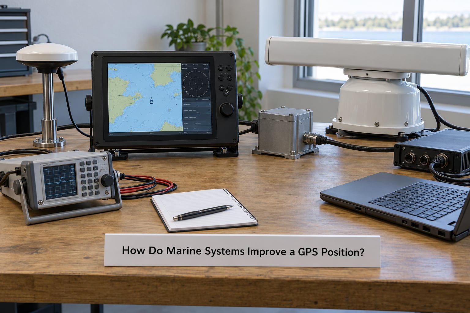
Each row buys accuracy in a different way, and they are not interchangeable. The first three improve accuracy. The last two mainly buy continuity when the signal is gone.
| Method | Typical horizontal accuracy | How it works | Where it fits on a vessel |
|---|---|---|---|
| Standard single-frequency GPS | 3 to 5 metres | One L1 band, broadcast data only | Basic position plot, waypoint marking, most coastal work |
| Dual-frequency GNSS | 1 metre or better | Two bands, ionospheric delay estimated and removed | Offshore survey, dredging, precise approach work |
| Multi-constellation receiver | 2 to 3 metres | GPS plus GLONASS, Galileo, BeiDou and others tracked together | Ocean passages where satellite availability matters more than raw precision |
| SBAS augmentation | 1 to 2 metres | Wide-area corrections from geostationary satellites: WAAS, EGNOS, MSAS, GAGAN, QZSS | Approaches and pilotage where the local service is supported |
| Differential GNSS | 1 metre or better | A reference station on shore broadcasts corrections over radio | Harbour, dredging and precision mooring, with a land station in range |
| Real-time kinematic | 1 to 2 centimetres | Carrier-phase corrections with a data link to the reference station | Hydrographic survey and quay-side positioning |
| Inertial navigation | Drifts; depends on the unit | Accelerometers and gyros propagate position from the last known fix | Redundancy through GPS outages, bridged by radar or visual fixes |
Multi-constellation reception deserves a note for boats. GPS is one system among several. A multi-constellation receiver also tracks GLONASS, Galileo and BeiDou, and depending on where you are, may see NavIC or QZSS. On open ocean, more satellites means more options for geometry and better continuity as low-elevation satellites set, which is a different kind of benefit than raw precision.
Integrity monitoring
Accuracy and integrity are different questions. RAIM, receiver autonomous integrity monitoring, uses redundant satellite measurements to check whether the computed position agrees with an alternative solution, and it can raise an alarm rather than quietly return a wrong fix. On an approach, an integrity alarm matters more than the last metre of accuracy.
Fusing other references
Radar, AIS and visual bearings give an independent check on where you actually are. Cross-checking position by hailing a passing ship is described by cruising skippers as a genuinely useful sanity check, and it works because the other vessel sees you with different equipment on a different day. Radar range and bearing give a fix that is completely independent of the satellites, at the cost of a range rather than a position measurement.
Inertial navigation and dead reckoning
An inertial navigation system takes the last good GPS fix and then propagates position by integrating acceleration and rotation. It is independent of satellites and can be better than GPS for short periods, but its error grows steadily with time. The technique of pairing it with periodic resets, from GPS when available and from radar or celestial sights when not, is the oldest form of sensor fusion and it still works.
Can GPS Be Blocked or Jammed at Sea?
Yes, and the four causes are different enough that they deserve separate treatment.
Intentional jamming
A jammer transmits noise on the GNSS bands to deny the signal entirely. In coastal regions with active conflict this is a documented reality, and vessels transiting those areas are advised to treat a GNSS outage as a possible cause rather than equipment failure. Coastal authorities publish current advisories, and shipping companies brief masters before transit.
Spoofing
A spoofer transmits signals that look like real satellite signals but place your vessel somewhere else. Unlike jamming, spoofing does not announce itself as an outage: the receiver simply shows a plausible position that is wrong. Replicating the full signal structure convincingly is difficult but not impossible, and the practical defence is cross-checking against independent sources. An AIS target that disagrees with your own position, a radar return that does not match, or a speed over ground that implies you are crossing a container terminal at 20 knots are all reasons to doubt the fix.
Accidental overload
Most interference on a boat is nobody’s fault. Radar transmitting next to the antenna, a bad coaxial run, a partially blocked skyview, a corroded connector, or an older receiver with failing sensitivity all produce the same symptom as deliberate attack. This is why the honest first step during any loss of fix is the boring one.
Weak satellite visibility
Near the edge of the constellation’s useful geometry, or under a hardtop or in a steel hull, a receiver may hold a two-dimensional fix with a high HDOP while technically still showing a position. That is the most dangerous state of all, because the display looks normal.
Why fix quality matters more than position
A receiver that reports fix type, satellite count, HDOP and per-satellite signal-to-noise ratio lets the operator know how much the position should be trusted. A position without those numbers is an assertion. Learn what your display shows, and check it before you need it rather than during a failure at night in a traffic separation scheme.
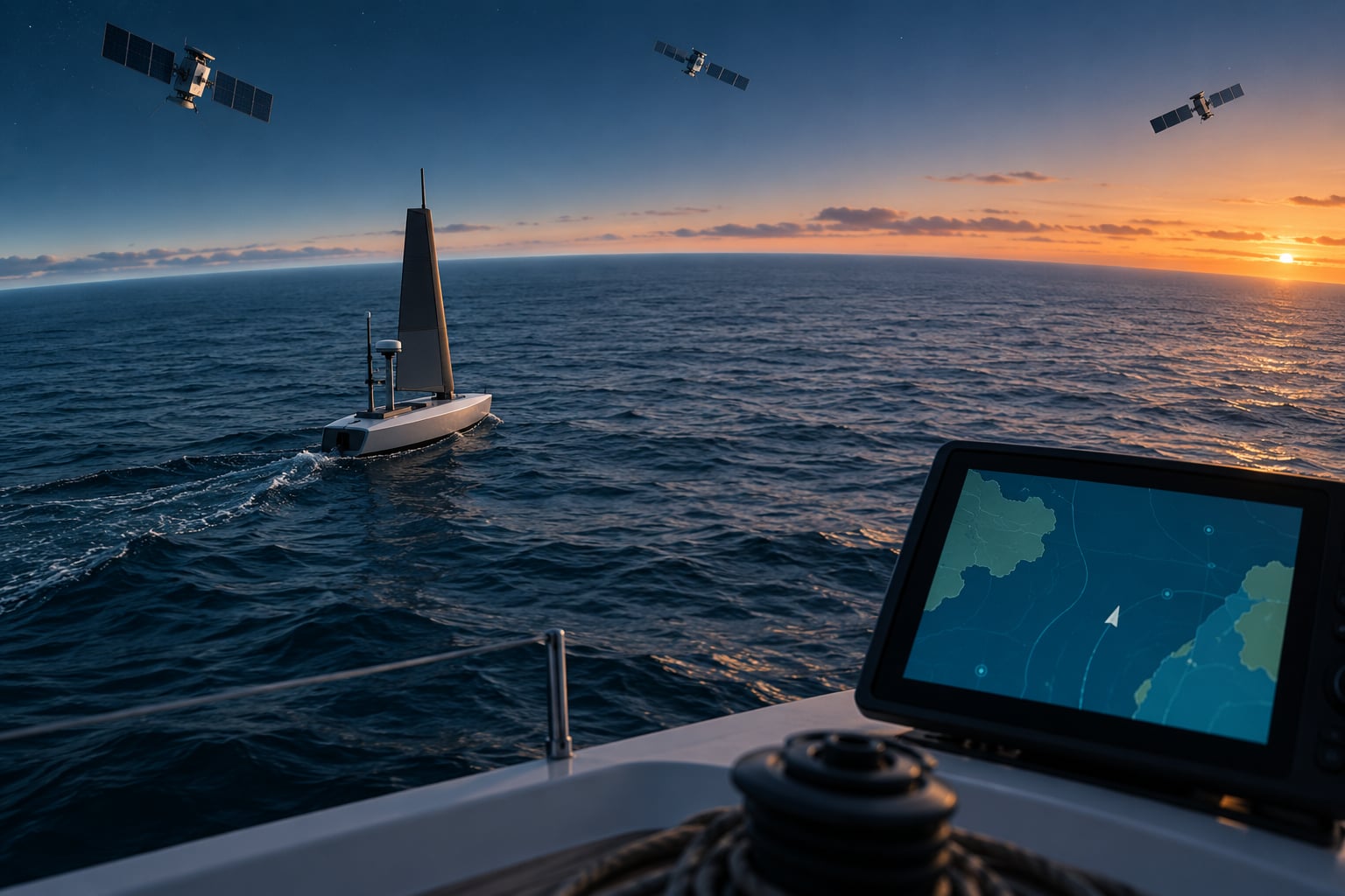
How Should a Sailing Robot or Ocean Drone Use GPS?
Autonomous platforms have no one to notice a drifting position, which changes the design requirements more than anything else about marine GPS.
Place the antenna for the mission
A surface platform needs a clear skyview and a rigid mounting that keeps the antenna phase centre fixed as the hull pitches. A buoy will roll and pitch continuously, so roll-decoupled antenna mounts exist and are worth specifying. An underwater vehicle cannot use GPS at all, which is the next point.
GPS does not work underwater
Seawater is highly lossy at L-band frequencies. A satellite signal arriving at the sea surface already has very little link margin, and water absorbs what little remains within the first few metres, so a submerged receiver gets nothing usable. Underwater positioning therefore relies on acoustics, inertial navigation, Doppler velocity loggers, pressure-based depth for vertical position, and, in some experimental work, gravity or magnetic field matching. An AUV surfaces briefly to get a fix and then navigates on dead reckoning underneath. That pattern is why surfacing intervals are a major design parameter in ocean robotics rather than a detail.
Set fix-quality thresholds
Log satellites used, HDOP, fix type and time to first fix on every logged position. Define a threshold, for example requiring a three-dimensional fix with HDOP below a set value, and make the platform refuse to accept a position below it. A logged record with a quality column is something you can analyse after the fact; a bare coordinate stream is not.
Plan for loss as a normal case
Estimate drift rate and define a hold, return or abort behaviour in advance, with the threshold written down before the mission rather than during it. Use geofences on the same geodetic position the vehicle uses, with a generous buffer, and log every entry and exit. Propagate position by dead reckoning from speed over ground and course over ground using an inertial or odometer estimate, and reset it on the next good fix.
Keep logs that survive the mission
Store raw receiver output, not just a cleaned-up track. Time jumps after a power event corrupt logs in ways that are painful to discover later, so log a monotonic clock alongside UTC, and check after a cold start that the date and time zone are correct before the vehicle leaves the dock.
Frequently Asked Questions
Why do I need four satellites for a GPS position?
A receiver solves for four unknowns: three position coordinates (latitude, longitude, altitude) plus the error in its own clock. Because the receiver’s crystal is far less accurate than the satellite’s atomic clock, that clock error is unknown and needs its own measurement. Three satellites give three distances, which is one equation short. Adding satellites beyond four improves geometry and lets the receiver reject a bad measurement.
Why does my GPS lose signal when I turn the radar on?
Marine radar transmits at very high power, and on many installations the radar antenna sits within a metre of the GPS antenna. Its radiation can overload the much weaker satellite signal so the receiver loses satellites entirely. Owners report that switching the radar off immediately restores the lock. Separating the two antennas, or fitting proper filtering and attenuators between the antenna and receiver, fixes it.
Is GPS more accurate at sea than on land?
Usually yes, and the reason is the absence of obstacles. Cities produce multipath from buildings and poor satellite geometry in narrow streets, both of which push error up. Open water gives a clean view of most of the constellation and almost nothing to reflect signals from, so a basic receiver often shows its best numbers of the whole week offshore. Accuracy then depends on the chart beneath you and on antenna placement.
Can GPS work underwater?
No. Seawater absorbs L-band radio signals heavily, and a satellite signal arriving at the surface already has very little margin. Within the first few metres of depth there is effectively nothing left to work with. Underwater vehicles get position by surfacing for a brief fix, by acoustic ranging to a known beacon, by inertial navigation, by Doppler velocity loggers, or by pressure sensors for depth.
What should I do if GPS fails on a boat?
Confirm the cause before assuming the worst: check satellite count and HDOP, then power the radar down and see whether the fix returns. If it does not, switch to a backup receiver or handheld with its own antenna, log the position manually in the logbook, and start dead reckoning using compass bearing, speed over ground from the log, and any radar or AIS returns. Compare the result with the chart, and tell someone ashore your plan.
How did sailors navigate before GPS?
They used dead reckoning, celestial sights, and the compass, then checked the result against the sea and the sky. Latitude came from the noon sun with a sextant; longitude came from timing the sun or moon against a chronometer, and by the twentieth century from radio time signals at sea. Courses were kept on a compass card, positions logged by hand, and landfall confirmed by bearing and distance once it was visible or audible.
Conclusion
Start with the parts you can inspect rather than the parts you can buy. Check the antenna for corrosion and a clear skyview, check the cable and connectors, confirm the display reports satellite count and HDOP, and verify the date and time after a power interruption. Then fit a second, independent receiver with its own antenna, so one failure cannot take out your position.
From there, treat GPS as one input rather than the whole navigation system. Pair it with a compass for heading, radar or AIS for an independent check, inertial navigation for the minutes after a signal is lost, and a paper chart and a logbook for the hour after that. That redundancy is what turns how GPS works at sea from a specification into a system you can rely on when the sky, the hardware or the signal stops cooperating.