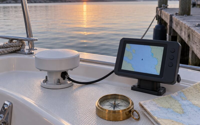
To log GPS data on a boat, you need a receiver that outputs position sentences, a logger to capture that stream, and a way to save it as a file you can replay later. Most people pick one of three routes: a phone or tablet app, the NMEA output from your chartplotter or instrument network, or a dedicated NMEA logger writing straight to a computer or SD card.
Whichever route you take, the rule is the same: test the whole chain at the dock before you rely on it offshore. A ten-minute harbor loop that proves you can capture, save and reopen a file saves an entire wasted passage.
Table of Contents
What You Need
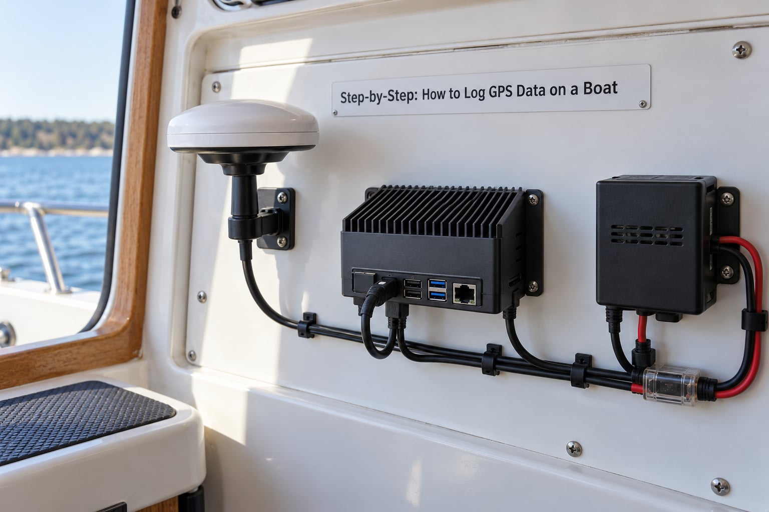
The core kit is small. A GPS receiver with a clear sky view, something to record the output, a power source, and a way to mount the receiver where spray and vibration will not get it.
- GPS receiver. A marine chartplotter with NMEA output, a standalone GNSS puck with a USB or serial port, or a phone. Marine units hold a fix better in heavy weather and often feed the same position to your chartplotter.
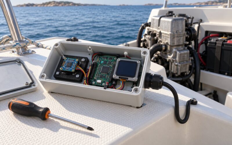
- Logger. A laptop, a Raspberry Pi or other single-board computer, an Arduino-compatible board with a GPS module and microSD slot, or a purpose-built NMEA data recorder.
- Connection hardware. A USB-to-serial adapter with an FTDI or CP210x chip, a waterproof NMEA 2000 to USB or Ethernet gateway, or a Bluetooth receiver for wireless NMEA. Avoid no-name serial adapters; they drop characters silently.
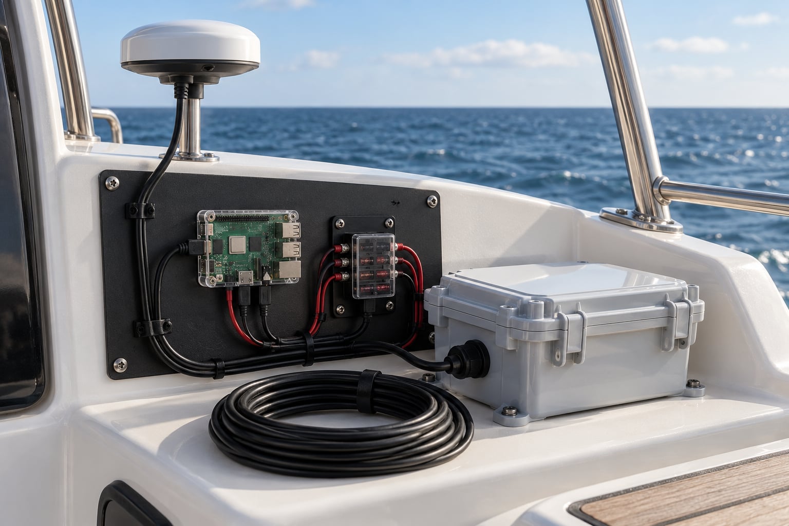
- Power. For an unattended install, a fused 12V supply with a low-voltage cutoff, plus a deep-cycle battery if the logger must survive with the engine off.
- Mounting. A sealed enclosure with a cable gland, a strain-relieved mount, and a fuse or resettable breaker on the supply.
- Optional sensors. NMEA 2000 wind, depth, engine and fuel sensors add a lot to a log if your network already carries them.
Which hardware is right depends mostly on what you want the log to prove. Comparing the three routes before you buy saves a lot of trial and error at the dock.
| Route | What you need | What you get | Watch out for |
|---|---|---|---|
| Phone or tablet app | Nothing beyond a mounted phone | Track, sometimes notes and geo-tagged photos | Battery drain, screen locked interruptions, wet-rated mounts only |
| Chartplotter or network output | NMEA cable or a NMEA 2000 gateway, plus software on a laptop | Raw sentences from every instrument on the boat | Baud rate mismatches and proprietary network buses |
| Dedicated logger or gateway | Recorder with storage, or a headless computer | Continuous unattended logging, multiple data sources, remote access | Clock drift and storage sizing |
| Open-source stack | Single-board computer plus gpsd or Signal K | Text logs you can post-process any way you like | You own the reliability engineering |
Step-by-Step: How to Log GPS Data on a Boat
Choose and Mount the GPS Receiver
Pick a receiver that outputs a format your logger understands, most often NMEA 0183 sentences over serial, and mount it with a clear, unobstructed view of the sky. A receiver under a fiberglass cabin roof will hold a fix far more reliably than one crammed beside a mast.
How do you know it is working? Mount it, power it, and watch the satellite count and position readout. It should show a position within a minute or two outdoors. Secure it so it cannot slide or buzz against a bulkhead, because constant vibration works loose every connector you have.
Connect the Receiver to a Logger
Connect the receiver output to the logger and write down the baud rate before you power anything up. For NMEA 0183, 4800 baud is common for AIS, while 38400 or 115200 baud is typical for a GPS or full instrument feed. Set the logger to match the device exactly.
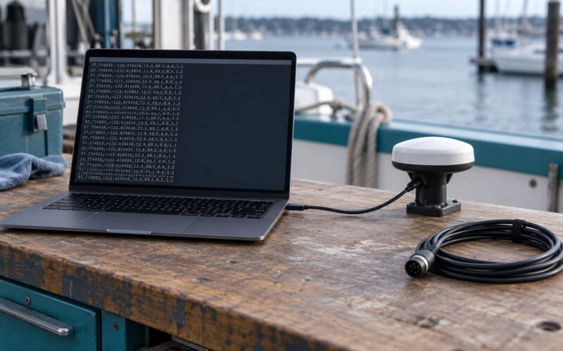
How do you confirm the wiring? With the logger running, open its data monitor. If you see clean lines of readable sentences scrolling past, the wiring and baud rate are both correct. Reversed wires or a mismatched rate produce scrambled characters or nothing at all.
On a NMEA 2000 network, you need a gateway rather than a direct cable. A USB or Ethernet gateway converts PGNs into NMEA 0183 sentences that ordinary software can read. Wireless NMEA over Bluetooth or Wi-Fi is worth it on a boat where running a cable to the cockpit is awkward, though it adds a failure point in salt air.
Configure the Logging Software
Set the fields you actually need, which usually means timestamp, latitude, longitude, speed over ground, course over ground and fix quality, then choose a plain text output such as CSV or a raw NMEA file. Vendors such as Actisense, AGG and GpsGate all ship recorders that can write straight to a log file, and free NMEA capture tools work if you already have a working serial link.
How do you know the configuration took? Start a one-minute recording, stop it, and open the file in a text editor. Real values in sensible columns mean the fields mapped correctly; empty columns mean a sentence type the tool does not parse, so pick a different sentence filter or a different tool.
Record a Test Track
Run a short loop out of the harbor and back with the logger recording the whole time. This is the step people skip, and it is the step that catches most problems before they matter.
Check five things before you leave: coordinates change while you move, timestamps advance at the interval you set, speed and course are not frozen at zero, the file is being written to disk, and the file size grows. A harbor loop of fifteen minutes should produce a track with a handful of sharp turns that you can compare against where you actually went.
Start Logging on the Water
On the water, start the recording before you leave the berth, confirm the file is open and growing, and check your supply and storage once an hour. Orient the antenna with the sky above it, keep cables clear of steering and throttle gear, and name files with the date and route so a season of logs stays sortable.
Log once a second for most purposes. Logging every raw sentence instead can fill a modest card in a day and adds little, because consecutive position sentences are nearly identical.
Download, Inspect, and Save the Track
Stop recording before you shut down, then copy the file rather than moving it, so a failed copy still leaves the original on the card. Open the track on a chart and look for gaps, straight lines across open water, and positions that jump inland.
Export a GPX or KML copy for mapping software and keep the raw file untouched. Keeping the raw log matters because conversion tools change coordinates and drop fields, and you may want to reprocess the original with different settings later.
Common Mistakes
Most failed logs come down to one of a handful of causes, and each has a quick fix once you can name the symptom.
No data recorded at all
The logger opened a file but nothing arrived. Check the device selector in the recorder, confirm the baud rate matches the receiver, and verify the ground or common wire is connected. A receiver with no fix yet also produces no positions, so leave it outdoors for a few minutes before judging it.
Garbled or unreadable sentences
Scrambled characters almost always mean a baud rate mismatch or a noisy connection. Try the other common rates one at a time, reseat the connector, and keep the data cable away from VHF antenna coax and engine wiring.
Corrupted or truncated files
Stopping the process by cutting power leaves a partial file. Stop the recorder cleanly, eject the card in software, and pull it. On a PC, treat card removal as a deliberate step rather than a reflex.
Gaps in the track
Gaps come from losing satellite fix under a canopy of cloud, a bridge, or a wooded shoreline, or from the logger’s clock slipping. Sync the clock over GPS or network time at the start of every session, and keep the interval long enough that one dropped fix does not erase a whole section.
The logger died mid-passage
A flat battery or a hot circuit breaker stops unattended logging without warning. Add a low-voltage cutoff, fuse the branch properly, and log voltage to a separate channel so you can see the supply sagging before it fails.
The track plots in the wrong place
A track that lands thousands of kilometers off is nearly always a coordinate reference or unit problem. Confirm your receiver is set to WGS84 and that exported files declare the same datum; chartplotters using a local datum need converting before they overlay correctly.
Frequently Asked Questions
What is the best way to log GPS data on a boat?
The best route depends on what you want the log to prove. A phone app is enough for trip notes and a rough track. Pulling NMEA from your chartplotter or NMEA 2000 network through a gateway is the best choice for a cruising boat, because it captures the full instrument feed. A dedicated logger or single-board computer is best for unattended and research work.
How often should a boat GPS logger record positions?
Once per second suits nearly every use, including race analysis and passage review. Recording every raw NMEA sentence generates far more data for almost no extra information and can fill a memory card in a day. If you only want a daily breadcrumb trail, drop to every ten seconds or every thirty seconds and save the storage.
Should I save NMEA sentences, GPX files, or both?
Keep the raw NMEA file as your master copy and export GPX for viewing. The raw log holds every sentence from every instrument and can be reprocessed later with different filters, while GPX is a simplified track most mapping tools open directly. Converting back from GPX to NMEA is not possible.
Can I use a phone to log GPS data while boating?
Yes, for most cruisers. Mount the phone in a waterproof holder, keep it plugged in, and set the screen to stay awake or use a logging app that records in the background. Phone accuracy is usually good near the coast and weaker offshore. If you also want depth, wind and engine data, you need hardware.
Do I need an internet connection to record a GPS track?
No. A receiver, a logger and local storage record a track with no connectivity at all, which is exactly what you want offshore. You need a connection only to download charts, sync a logbook, or copy files off the boat later. Many charting apps cache their tiles for offline use once you have loaded the area.
Can a marine chartplotter also record GPS data?
Most modern chartplotters can record tracks, either continuously or by marking start and end points, and many ship with free desktop software for downloading and exporting them. Storage and export formats vary by brand, so check whether your unit writes a proprietary file or a GPX track before you rely on it as your only log.
Conclusion
Start with the receiver and the route that fits your boat, then run a fifteen-minute harbor loop and confirm you can reopen the file on shore. Once that test passes, set your interval, name your files sensibly and let it record. The hard part of logging GPS data on a boat is never the recording itself, it is checking the chain before you need it.