Knowing how to improve GPS accuracy on a small boat comes down to two things: the antenna cannot see enough sky, or something electrical on board is smothering the signal. Move the antenna to a clear, elevated spot, rule out interference by powering equipment up one item at a time, and confirm your receiver is using the same datum as your charts. That sequence fixes most cases in an afternoon.
The sting is that a bad fix still looks like a fix. Your chartplotter shows a boat icon, a heading and a position, and nothing warns you the error is 30 metres instead of 3. Learning to read the satellite display is what separates a guess from a measurement.
Table of Contents
- What You Need
- Step-by-Step: How to Improve GPS Accuracy on a Small Boat
- How to improve GPS accuracy on a small boat by checking the receiver and power supply
- How to improve GPS accuracy on a small boat by choosing a better antenna location
- How to improve GPS accuracy on a small boat by reducing signal interference
- How to improve GPS accuracy on a small boat by checking datum and augmentation settings
- How to improve GPS accuracy on a small boat by testing the result
- Common Mistakes
- Frequently Asked Questions
- How accurate should GPS be on a small boat?
- Does a higher number of satellites always mean better GPS accuracy?
- Where should I mount a GPS antenna on a small boat?
- What causes GPS position errors around water and boats?
- Should I use an external marine GPS antenna?
- How do I test whether my GPS accuracy has improved?
- Conclusion
What You Need
A repeatable diagnosis needs more than a screwdriver. Gather this first, and you can methodically eliminate causes instead of swapping parts at random.
- Access to the receiver’s satellite page, showing satellites in view, signal strength bars and the accuracy estimate in metres.
- A known reference point — a dock, a channel marker or a bridge span whose position you can check against a chart, paper or a trusted reference.
- Handheld receiver or phone with GPS, for a second opinion when the onboard unit disagrees with the real world.
- Multimeter to check the 12 V supply at the receiver, including under engine load and with the outboard tilted.
- Mounting hardware: a small pedestal, a through-deck or hardtop mount, marine-grade sealant and stainless fasteners.
- A spare antenna and cable if you want to compare positions without dismantling anything.
Worth adding to the list: a roll of proper marine coax or at least a known-good short cable, since a marginal cable is far harder to diagnose later.
Step-by-Step: How to Improve GPS Accuracy on a Small Boat
Work through the steps in order. Each one rules out a category of cause, and skipping ahead means you may move the antenna to fix an interference problem you never identified.
How to improve GPS accuracy on a small boat by checking the receiver and power supply
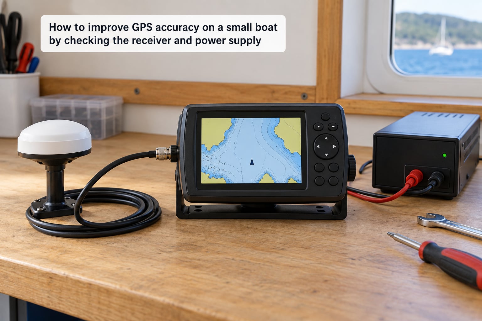
A GPS receiver fed unstable power produces degraded fixes that look like a sky problem. Check the supply voltage at the receiver with the engine running, the electronics on, and the outboard tilted over. A reading that sags several volts under load will show up as a wandering position even with a perfect antenna.
Next, confirm the receiver is actually listening to the antenna you think it is. Trace the coax from the unit to the mount and make sure it ends where you expect, because units with an internal patch antenna will happily lock onto their own built-in element even with a better external one wired in and not properly selected.
In the satellite page, look for a steady count rather than a number that climbs and falls. A fix quality of 1.0 or better and a horizontal dilution of precision under 1.5 is what you want with everything switched off. Note the number down, because that is your baseline for the next step.
How to improve GPS accuracy on a small boat by choosing a better antenna location
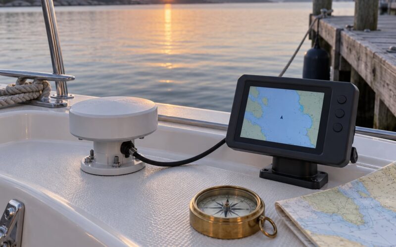
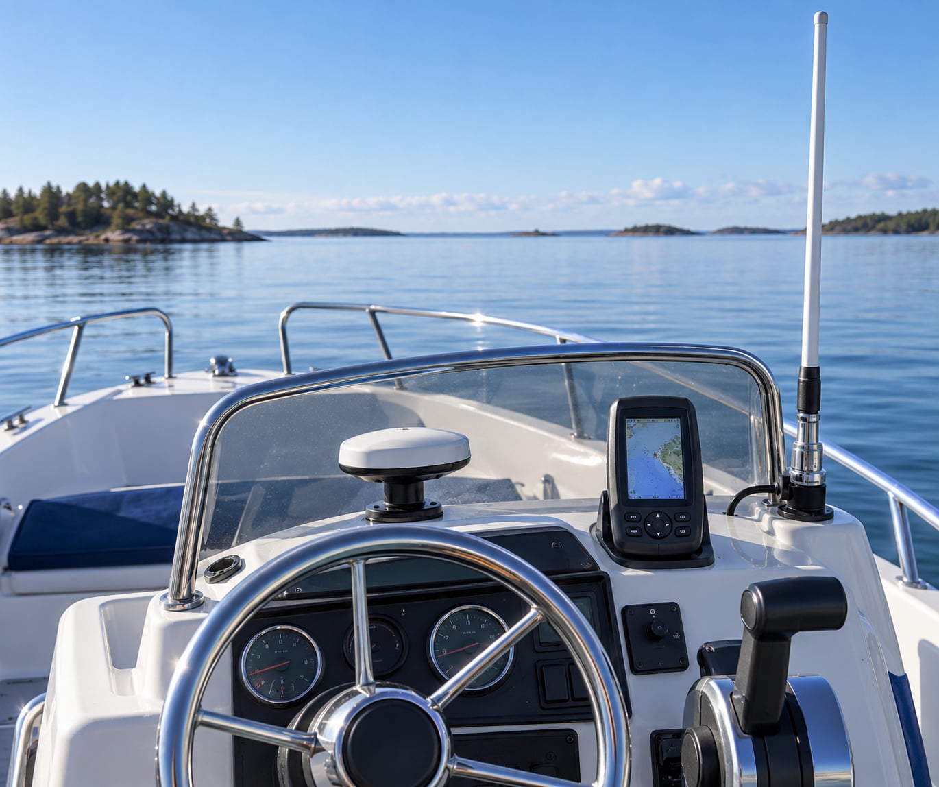
Height and clear sky beat antenna gain almost every time. A modest antenna on top of a hardtop will outperform a high-gain unit bolted to the base of a console with a T-top and rod holders overhead, because the satellites are spread across the sky and a blocked sector costs you more than extra gain recovers.
On small boats the usual offenders are the hardtop itself, a T-top, a bow rail mount, a pedestal tucked under a canopy, and anything within a few metres of the water when you pitch or roll in a seaway. Forum owners on thehulltruth describe the common fix plainly: remove the pedestal and cone and mount the antenna directly in the hardtop to gain height. On aluminium boats, owners on westernbass make a similar point — the hull is seldom the problem, but metal above the antenna absolutely is.
Give the antenna an unobstructed view all the way around the horizon, not just overhead. A satellite signals from low on the horizon, so a small obstruction at antenna height can block more of the useful sky than you would expect.
How to improve GPS accuracy on a small boat by reducing signal interference
Interference is the cause owners report most and diagnose least, and it is the one that trips up most people trying to improve GPS accuracy on a small boat. Amplified satellite TV antennas, VHF radios, radar, and switching power supplies all emit noise into the GPS band, and the symptom is a sudden collapse in signal strength when a particular device comes alive.
The isolation test is simple and repeatable. With the boat stationary and everything off, record satellites in view and the strength bars for each. Then power up one device at a time — electronics first, then trolling motor, then VHF, then radar, then the TV amplifier — and watch the bars after each one.
If the strength drops the moment a device powers on, you have your culprit. Common fixes include switching off the amplifier on a satellite TV antenna, checking that the coax shield is properly grounded, adding ferrite chokes near the GPS unit, and rerouting the GPS cable away from power leads and switching supplies.
Trolling motors deserve their own attention. The motor’s PWM switching supply, its long power run and the transducer cable bundled alongside are a common source of noise, especially on bow-mounted units where the sonar and GPS share a location. Owners report that running the trolling motor and the chartplotter simultaneously degrades both. Try powering the electronics from a clean feed rather than through the motor’s own supply, and separate the transducer and GPS cables where the route allows.
Do not add unverified shielding or homemade filters. A ferrite choke or a rerouted cable is a known, reversible change; an improvised suppressor can make the problem harder to find.
How to improve GPS accuracy on a small boat by checking datum and augmentation settings
If the position is off by a few hundred metres while the signal strength looks fine, the receiver is probably not at fault. A receiver set to a different geodetic datum than your chart will plot your true position somewhere else entirely. Most modern units default to WGS84, which is what virtually all current digital charts use, so verify rather than assume.
Next, check that satellite-based augmentation is switched on. WAAS in North America, EGNOS in Europe and the equivalent elsewhere are free correction signals that typically bring a standard fix from around 3 metres down to about 1 metre. It is often one toggle in the settings menu and it is the single cheapest accuracy improvement available. Owners who have never checked it are usually getting no correction at all.
While you are in the settings, confirm the distance units, and check whether the unit is set to a 2D or 3D fix preference if that option exists. Three satellites give a 2D fix with altitude assumed to be zero, which degrades the speed and course derived from successive positions — noticeable when trolling slowly or holding a drift.
How to improve GPS accuracy on a small boat by testing the result
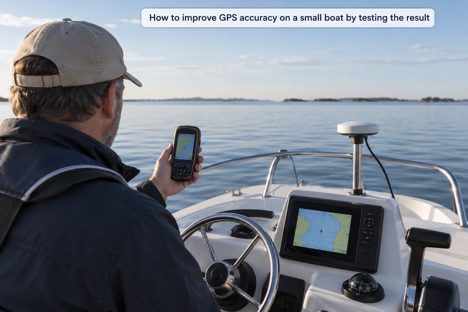
Without a measurement, a fix is just a feeling. Pick a known point, moor or hold station alongside it, and record the onboard accuracy reading, the satellite count and the bar strength. Compare that with a handheld unit or phone at the same spot, and note the disagreement in metres.
Then run a short course at low speed in clear water, say 200 to 300 metres, and watch whether the track stays where you actually went. Repeating that pass a few times tells you more than a single static reading, because multipath errors show up when geometry changes rather than when you sit still.
Record time to first fix as well. A cold start that takes 15 to 20 minutes usually points to an internal antenna under a hardtop rather than to anything wrong with the receiver. Most cold-start problems improve with a good sky view, and the almanac downloads faster once the unit has been outdoors with power.
One more thing worth separating: update rate. Owners often talk about 10 Hz receivers as though they are more accurate, but a 10 Hz unit simply reports position ten times a second. It feels smoother at low speed. It does not move the true accuracy of a single fix. Higher update rates on u-blox-based receivers are a responsiveness improvement, not a precision one.
Common Mistakes
Mounting the antenna low under a hardtop. It works until you pass a bridge, a building or a tree line and the error jumps. Fix: raise it, even if that means relocating the whole mount.
Treating update rate as accuracy. A fast update makes a plot look smooth while the underlying error stays the same. Fix: judge the fix by the accuracy estimate and by comparison against a reference point.
Blaming the aluminium hull. The hull is rarely the culprit; metal above and around the antenna is. Fix: check the sky view first, not the hull material.
Leaving augmentation off. A receiver running without correction is simply not using the free improvement sitting overhead. Fix: enable WAAS, EGNOS or the local equivalent in the settings menu.
Never verifying the datum. A mismatch between receiver and chart produces errors far larger than anything signal strength can explain. Fix: set the datum to WGS84 to match your charts.
Testing only while stationary. A static reading under open sky flatters a badly mounted antenna. Fix: run short passes in different directions and watch the track.
Rewiring the whole boat when the fix is a coax problem. Salt water gets into connectors and coax degrades faster than most people expect. Fix: inspect the connectors, reseal them, and check the cable for chafe where it passes through a deck fitting.
Two-minute pre-departure check: confirm the satellite count and strength bars, confirm the accuracy estimate is under 10 metres, confirm your own position against a chart landmark, and confirm the heading agrees with where you are actually pointing. That takes less time than finding a bad marker at night.
Frequently Asked Questions
How accurate should GPS be on a small boat?
With a clear view of the sky, a healthy consumer receiver typically reports about 3 metres of position accuracy. Anything under 10 metres is normal and acceptable for small-boat navigation. A reading above 10 metres usually points to an installation problem such as a blocked sky view, onboard interference or a poor antenna location, not to a faulty receiver. With satellite-based augmentation enabled you can often see 1 metre or better.
Does a higher number of satellites always mean better GPS accuracy?
No. A receiver needs at least four satellites for a three-dimensional fix, and three gives a two-dimensional fix with altitude assumed to be zero. Beyond that minimum, more satellites in view usually means better geometry, but accuracy also depends on where those satellites sit in the sky, how strong each signal is, and whether anything nearby is adding noise. A blocked antenna can still show a healthy satellite count while producing a poor fix.
Where should I mount a GPS antenna on a small boat?
Mount it as high as practical with an unobstructed view of the sky in every direction. On a small boat that usually means the top of the hardtop, a T-top or a forward rail position, rather than a console pedestal under a canopy. Keep metal, rod holders and wiring away from the antenna, and give it as much separation as practical from VHF, radar and satellite TV antennas.
What causes GPS position errors around water and boats?
The most common causes are a blocked view of the sky, interference from VHF radios, radar, amplified satellite TV antennas and switching power supplies, and multipath reflection off a hardtop, a cabin roof or a nearby structure. Datum mismatch between the receiver and your charts can add errors of several hundred metres, and cold starts can take 15 to 20 minutes when an internal antenna sits under cover.
Should I use an external marine GPS antenna?
If your receiver supports one and the built-in element is mounted under a hardtop or inside a display, an external antenna on a clear elevated mount is usually the biggest single improvement available. It also lets you place the antenna where the sky view is best rather than where the wiring is convenient. Choose a sealed marine-rated unit with a clear view of the horizon and verify the improvement with a comparison pass.
How do I test whether my GPS accuracy has improved?
Test at a known reference point such as a dock or marker, and record the onboard accuracy estimate, satellite count and signal strength. Compare the same reading from a handheld unit or phone at the same spot. Then run short passes in clear water in two different directions and watch whether the plotted track matches where you actually went. Write the numbers down before and after so the change is measurable.
Conclusion
If you are still not sure how to improve GPS accuracy on a small boat, start with the install, not the hardware. Check the receiver and its power supply, confirm it is listening to the antenna you think it is, and get a baseline accuracy reading with everything switched off.
Then test at a known point, move the antenna to a clear elevated spot away from metal and other antennas, run the one-at-a-time power-up test to catch interference, and make sure augmentation is on and the datum matches your charts. Record the numbers before and after. If the accuracy estimate drops from 30 metres to 3, you have a fix you can rely on rather than a guess.