Understanding how satellite messengers work at sea comes down to one simple chain of hops. Your device grabs a position fix from GPS, packages your text into a data burst, beams it up to a low-Earth-orbit satellite, and that satellite passes it down to a ground station. From the ground station it travels over the ordinary mobile internet to your contact’s phone, browser or a rescue coordination centre. A delivery confirmation comes back the same way.
That chain is why satellite messaging feels slow compared to a phone, and why a device that will not send from a steel cockpit or a lee shore is a common complaint rather than a fault. Once you understand the path, most of the confusing behaviour on a boat stops being mysterious.
Last updated: October 2026
Table of Contents
- How Satellite Messengers Work at Sea
- What Happens When You Send a Satellite Message?
- What Can a Satellite Messenger Do at Sea?
- How Accurate Are Position Reports?
- Why Reception Depends on Open Sky
- What Affects Battery Life and Message Speed?
- How Do Iridium and Inmarsat Services Differ?
- How to Choose a Satellite Messenger for Marine Use
- Satellite Messenger or Marine VHF Radio?
- How to Test and Maintain a Satellite Messenger on a Boat
- Frequently Asked Questions
- What to Do Before Leaving Cell Coverage
How Satellite Messengers Work at Sea
A satellite messenger is a handheld or mounted device that uses a low-Earth-orbit satellite constellation to send and receive short text messages, position reports and small weather files anywhere on Earth, including far beyond cellular coverage. It gets a GPS fix on your position, you type a short message, and the device transmits it by radio uplink to a passing satellite, which relays it to a ground station. From there the message is routed over the regular internet or to a 24/7 rescue coordination centre, and a delivery confirmation travels back to you.
Two things follow from that description. The device needs line of sight to a satellite, and it is a messaging tool, not a distress beacon. Both points get covered below, because they are where most real-world disappointment comes from.
What Happens When You Send a Satellite Message?
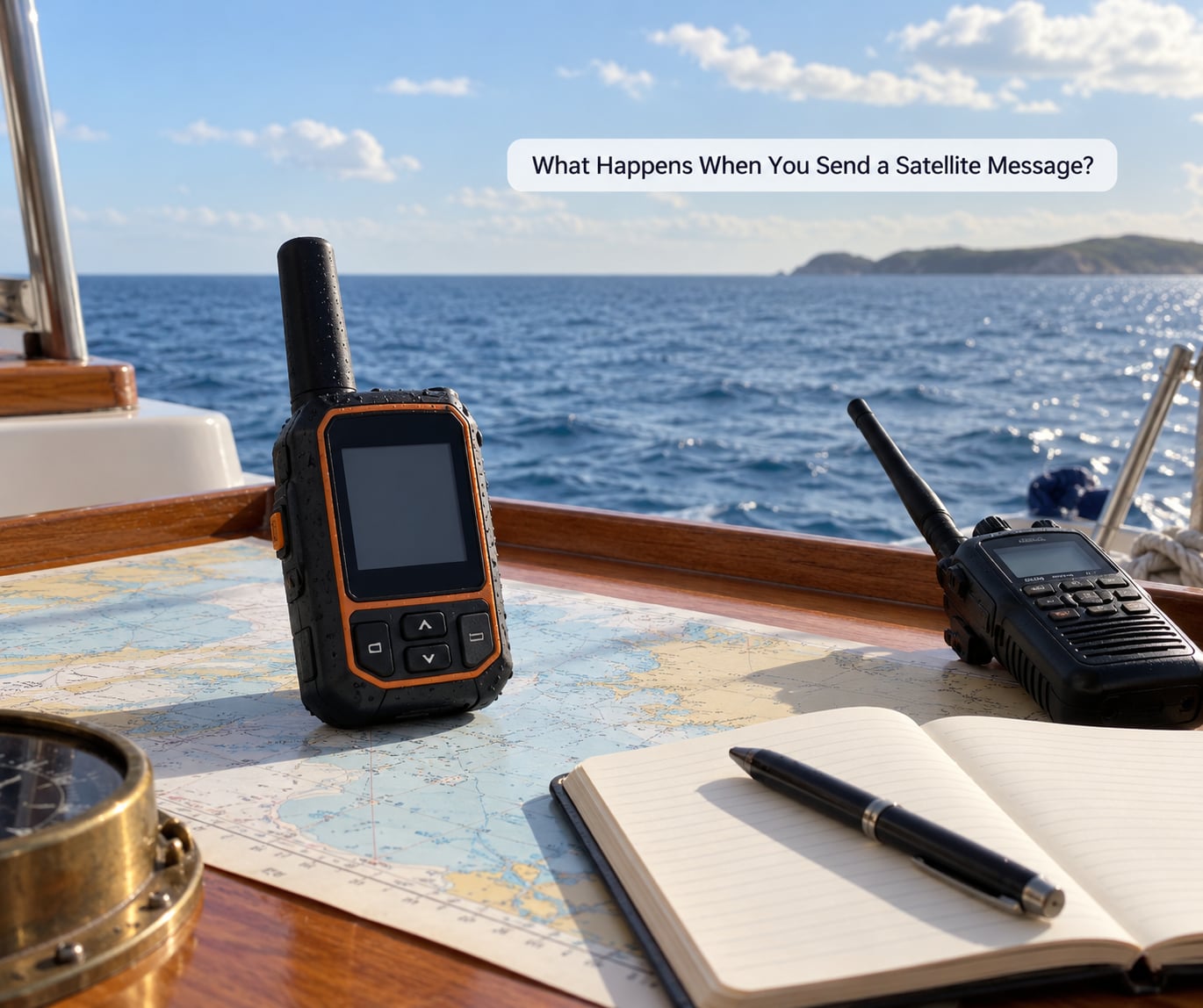
The step-by-step path is short, but each stage has a failure mode of its own. Knowing which stage stalled tells you what to fix.
- Acquire a position fix. The device listens to GPS and other GNSS constellations until it has enough satellites to compute latitude and longitude. On a cold start with a wet antenna this can take several minutes. It cannot send a position it has not worked out yet.
- Compose and encode. You type a short text, or the app attaches your coordinates, a waypoint, a track breadcrumb or a small weather file. The message is compressed and split into packets sized for the satellite link.
- Uplink to a satellite. The device transmits on the network’s radio frequency to whichever satellite is in view. Iridium handhelds usually need a clear view of a specific satellite; Globalstar-style networks use a broader sky view. This is the step that fails under an obstruction.
- Satellite relays. The satellite receives the burst, switches it to a downlink beam and sends it toward a ground station. Nothing is stored on the satellite in most cases; it is a relay, not a mailbox.
- Ground station routing. The gateway hands the packet to the network’s message centre, which resolves your contact or your SOS target. A normal text goes out over mobile data and SMS. An SOS alert goes to a rescue coordination centre staffed around the clock.
- Delivery and confirmation. The recipient’s phone, email or the rescue centre receives the message. A short receipt travels back down the same path so you know it landed, which matters far more when you are alone than the delivery time itself.
How the Satellite and Ground Network Relays Your Data
Iridium is the clearest example. Its constellation sits roughly 780 km up and moves across the sky, so a handheld on deck may be able to see a satellite for only a few minutes at a time. The device locks onto one, sends its packets, and hands off to the next as it comes over the horizon.
Globalstar and Iridium Certus work on the same broad principle with different frequencies and a wider sky view, which is why some devices send from places where others will not. Geostationary services such as Inmarsat and Thuraya park a satellite in a fixed spot above the equator, so the device can point at one spot and hold the link, but a fixed satellite sitting low on the horizon can drop out entirely as your boat moves north.
Delivery time is the sum of all of it: time to lock onto GPS, time to acquire a satellite, time to transmit, routing, and a confirmation round trip. A short text on a good sky view often lands in well under a minute. A long message, a queued file or a device that is repeatedly searching for a satellite can take many minutes. That is normal, not broken.
What Can a Satellite Messenger Do at Sea?
A messenger handles short text both ways, position sharing, weather, and distress alerts. It sits in a specific place on the boat that a phone and a radio cannot.
- Two-way text. The core function. You write to a named contact and get a delivered receipt, which is the difference between a messenger and a tracker.
- SOS with interactive response. Press the button and the alert goes to a rescue coordination centre along with your position, vessel name and registered emergency contact. On most models you can cancel it if the situation resolves before help is committed.
- Check-ins and scheduled tracking. Send a short routine update on a timer so shore knows you are alive and where you are, without anyone aboard having to remember.
- Location sharing. Relatives watch a breadcrumb trail on a phone or web map. The trail is a courtesy and planning tool, not a safety net.
- Weather. Many services deliver forecast text for a set of coordinates. The real ocean product is the GRIB file, downloaded over satellite or cellular, which gives you wind and pressure fields rather than a paragraph of description.
- Telemetry and app links. Sensors, waypoints, track logs and, on newer hardware, small photos and voice memos. Photograph transfer is the exception that surprises people, and it costs far more airtime than text.
Here is the boundary worth being clear about. A satellite messenger is not a satellite phone: a sat phone is voice-first, needs a SIM and a talk plan, and expects you to speak. A messenger is text-first, runs on a monthly service or airtime plan, and charges by the message. Neither replaces a VHF radio, which handles ship-to-ship and ship-to-shore voice within radio range at no ongoing cost.
How Accurate Are Position Reports?
A consumer GNSS receiver outdoors with a clear sky view is typically accurate to a few metres, and a reported boat position will look believable to the nearest few metres. That is the device’s own answer to the question where am I.
A distress position is a different thing. For an EPIRB or a registered PLB, the 406 MHz signal is processed by the COSPAS-SARSAT system and passed to a rescue coordination centre, where the alert carries the registered vessel or person details and the position that was in the burst. A modern beacon also transmits a 121.5 MHz analogue homing signal that searchers can home on from close range, so the crew can refine the position once they are nearby. The coordinates the device computed at the moment of pressing are the starting point, not the final one.
Two things make a position worse. Antenna placement is the first: a GPS antenna inside a cabin roof, under a bimini or against a mast can pick up multipath reflections and drift several metres. A boat with a hard structure overhead has a permanently degraded fix, and it has no cure except moving the antenna or accepting the error.
Power-up time is the second. A cold receiver, damp conditions and a partially blocked sky all stretch the time to first fix. A device that reports a position three minutes after a button press is normal for a cold unit.
Why Reception Depends on Open Sky
Reception depends on an unobstructed view of the sky because the link between the handheld and the satellite is a radio beam that has to reach space. Anything solid between them removes it.
The obstructions that bite hardest on a boat are a steel or GRP deckhead, a canvas dodger, a mast and its rigging, a hardtop, a cabin roof, and the horizon itself. A cliff or a tall island has the same effect as a deckhead, which is why a unit that works fine at anchor can refuse to send on a lee shore.
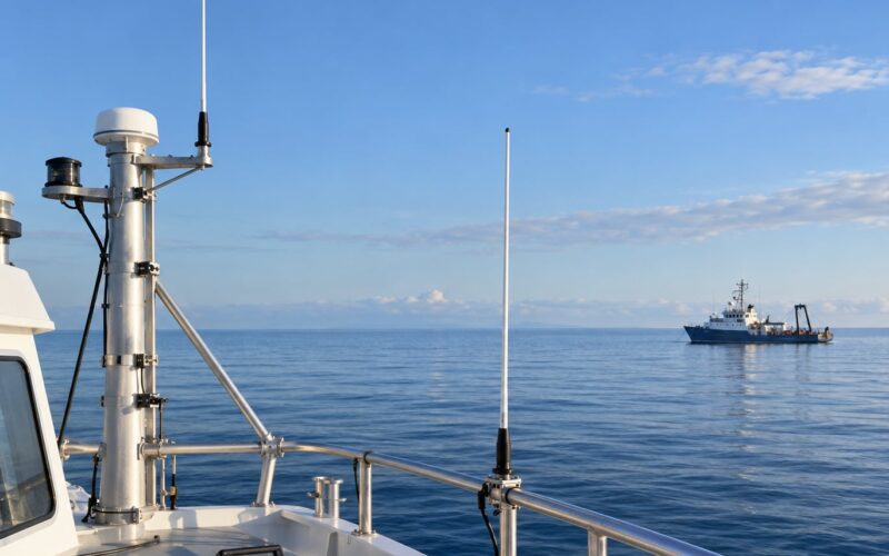
Placement follows from that. The best spot is the highest point with the widest sky, which on most cruisers is the mast top or the pushpit area, clear of rigging and away from the shrouds. A bulkhead or rail mount on the aft deck is next best. Inside a cockpit under a hardtop is a compromise. Down in the saloon, below a metal deckhead, it will not work at all on most LEO networks.
Two practical habits help. Keep the device out and in the open rather than in a dry stowage when you are expecting to use it, and test sending from the actual spot you will send from rather than from the companionway. If you are putting a permanently mounted antenna on the mast, budget for a proper mast-mounted unit and a run of low-loss cable back to the electronics rather than a patch antenna stuck to a surface.
What Affects Battery Life and Message Speed?
Battery life and message speed are both driven by the same handful of variables: how hard the radio is working. Cold costs a lot, and the biggest single drain is a receiver searching for satellites it cannot see.
| Factor | Effect on battery | Effect on send speed |
|---|---|---|
| Cold weather | Battery capacity drops and transmit power rises, so the same message costs noticeably more energy | Unchanged, but more retries are likely on a marginal link |
| Poor signal or blocked sky | The steepest drain of all, because the receiver transmits at full power repeatedly while searching | Much slower, with long pauses between retries |
| Message length | More packets, more transmit time, more energy per message | Longer transmit, then a similar confirmation wait |
| Tracking interval | Frequent scheduled pings add up quietly over a passage | No effect on your own messages, but more airtime use overall |
| Transmit power and antenna | A high-gain antenna lets the unit close the link at lower power | Faster first attempt and fewer retries |
| Battery capacity and spare cells | Sets how many days of cold-weather messaging you can cover | No effect |
Budget for a multi-day passage rather than a single day. Offshore the realistic pattern is a top-up charge at midday, fresh cells stowed dry, and a power bank or panel in the mix if you are not near the helm. Turning scheduled tracking down to a longer interval while under sail and back up when you want shore to watch you is the easiest saving available.
How Do Iridium and Inmarsat Services Differ?
The two networks differ in orbit, which changes coverage, speed and hardware in ways that matter to a small boat.
| Factor | Iridium and LEO networks | Inmarsat and Thuraya, geostationary |
|---|---|---|
| Satellite position | Circling at roughly 500 to 2,000 km, moving across the sky | Fixed above the equator |
| What a handheld needs | Clear view of a specific satellite | Clear view of one fixed spot, often low on the horizon |
| Latitude behaviour | Coverage holds up further north | Signal degrades at high latitudes as the satellite sits lower |
| Typical feel | Short and snappy on a good sky view | Steady link once acquired, slower to establish |
| Typical hardware | Small handhelds and trackers | Larger sat phones, multifunction terminals |
| Strong suit | Short text, SOS, tracking from a small boat | Voice and higher data volumes from larger vessels |
Coverage maps are marketing documents with real consequences, so treat them as a guide. Local terrain, your antenna height and the specific longitude of your route all shift the practical picture. Confirm service availability for the areas you actually plan to cross before you leave, and re-check it for any region you reach by ice or weather detour.
Inmarsat also has a long-standing role in maritime safety and distress alerting as part of the global maritime distress and safety system, and government and military users are significant customers of both Inmarsat and Iridium. That context matters mainly because those networks are held to different availability obligations than a consumer messaging plan, which is a good reason to keep a registered beacon as your distress link and treat the messenger as the communication tool.
How to Choose a Satellite Messenger for Marine Use
Choose on the following, in this order, and ignore resolution and screen size until the basics are right.
- Waterproofing. Look for a stated ingress rating rather than a marketing word. A unit rated for submersion survives a dunk in a wet locker; a splash-rated unit may not.
- Antenna performance. This is the difference between a device that sends from the deck and one that does not. A high-gain or mast-mounted arrangement is worth more than any feature below it.
- SOS behaviour. Check whether the alert routes to a staffed rescue coordination centre, whether it includes your position and vessel details, and whether you can cancel it. Confirm what registration is required and that your details are loaded before departure.
- Power. Battery capacity, whether it runs off USB while transmitting, and whether spare cells are available in your size.
- Tracking and check-ins. Adjustable intervals, breadcrumb trails, and whether tracking can be paused.
- Service cost. Compare airtime plans on real usage. A passage needs far more messages than a coastal weekend, and a year-round plan suits a boat that goes out regularly.
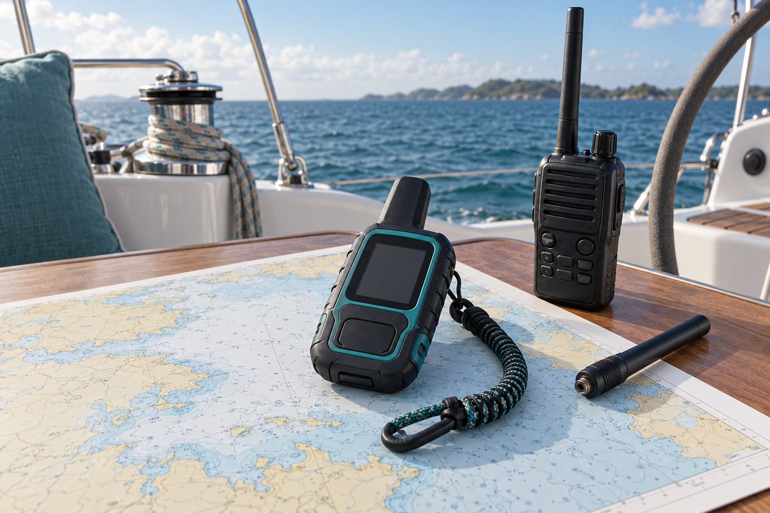
- Mounting. A lanyard for a lifejacket, a belt clip for a grab bag, and a bulkhead or rail option for a helm unit.
- Regulatory items. Registration of the device and, where it is carried, of the vessel and the emergency contact, so that the alert identifies you and your boat to whoever receives it.
Durability matters as much as the electronics. Salt spray and UV do more damage offshore than any expected number of messages. Rinse the unit in fresh water after a day in the sun, keep the charging contacts dry, and check the seals on your grab bag closure.
Satellite Messenger or Marine VHF Radio?
A satellite messenger is one layer of an offshore stack, not a replacement for it. Each device covers a different range, and the gap between a handheld VHF and a satellite is enormous.
| Range | Two-way message | Distress alerting | Ongoing cost | |
|---|---|---|---|---|
| VHF handheld | Line of sight, often a few miles offshore | Voice, free | Yes, DSC distress alert to nearby coast stations | None |
| Mobile phone | Coastal towers only | Voice and data, cheap | No | Normal plan |
| Satellite phone | Ocean-wide | Voice, by the minute | Usually via a separate beacon | Talk plan and airtime |
| Satellite messenger | Ocean-wide with clear sky | Short text, low airtime cost | Yes, to a rescue coordination centre, cancellable | Monthly or annual plan |
| PLB | Ocean-wide | No, one-way alert only | Yes, 406 MHz distress alert to COSPAS-SARSAT | None after registration |
| EPIRB | Ocean-wide | No, one-way alert only | Yes, registered vessel distress beacon | None, but registered and maintained |
The routine traffic offshore is still VHF and AIS between vessels, not satellite. A satellite messenger earns its place by reaching shore from beyond radio range, and a registered EPIRB or PLB earns its place by alerting rescue services when nobody has the time to press anything. Carrying one and not the other leaves a hole; carrying both is the sensible arrangement.
Island and coastal nations do not all recognise foreign EPIRB or PLB registrations the same way, so check yours before you sail rather than at the moment you need it.
How to Test and Maintain a Satellite Messenger on a Boat
A messenger that has not been tested is a paper device. Ten minutes in the dock saves a passage.
- Activate the service and check registration. Confirm the subscription is live and that your emergency contact and vessel details are correct, since that is what a rescue centre reads out.
- Update the firmware. Do it on shore power and cellular data, not on passage.
- Send a test message and wait for the receipt. Do this from the spot you will actually send from, ideally with a friend on the other end who confirms independently.
- Check sky view there. If it does not send from the intended mount, move the mount. Repeating the send at the same failing spot is not a test.
- Load contacts and check permissions. Make sure the app can reach your phone, and that your position is being attached automatically.
- Download charts and GRIB data. Do it on wifi. A forecast you cannot load is a forecast you do not have.
- Charge, rinse and stow. Fully charge, rinse in fresh water, dry the contacts, and seal the unit in the grab bag with the lanyard and spare cells.
Onboard, keep it in your hand, your pocket or the grab bag rather than a locker, and top it up at the same time each day. A fixed bulkhead mount with a run to a power source removes the charging chore entirely if you are installing one for the season.
Frequently Asked Questions
Do satellite messengers work on open ocean?
Yes, and open water is where they work best. With no cliffs, no buildings and no other traffic, a LEO satellite has a clear path to your antenna. The practical limits are the equipment, not the sea. You need a clear sky view, a charged battery, and an active service. Coverage does fall off at high latitudes for geostationary networks, and heavy sea state can make a handheld awkward to hold, but nothing about open ocean itself defeats the link.
Can I send photos with a satellite messenger?
On some newer models, yes, and this is where the airtime bill bites. A compressed photo is a large payload for a narrow link, so it takes considerably longer than a text and consumes a big chunk of your plan. Most satellite messaging services are built for text first, and older or smaller devices cannot send images at all. For passage planning, a voice memo or a written position update costs far less and arrives in a fraction of the time.
Are satellite messengers waterproof enough for a small boat?
They are built for it, but check the stated ingress rating rather than trusting the word waterproof. A unit rated to IPX7 survives immersion, which is what a wet grab bag or a washdown actually means. Splash resistance covers spray and rain but not a dunk. Offshore the real enemies are salt, UV and a connector left damp, so rinse in fresh water after use, dry the contacts and check the seals each time you re-stow it.
Does a satellite messenger work inside a boat cabin?
Sometimes, and it depends on your boat and your network. Iridium-style handhelds need a clear view of a specific satellite, so a steel or fibreglass deckhead over the saloon will usually block the link entirely. Networks with a wider sky view can sometimes get a message out from inside. The test is cheap: send one from the cabin before departure. If it fails, plan to send from deck, and treat the cabin as a receiver-only location.
Do I still need a VHF radio or life raft beacon offshore?
Yes. A satellite messenger is a communication tool with a distress button attached, not a certified distress beacon. A VHF radio with DSC covers ship-to-ship traffic and alerts coast stations within radio range at no cost. A registered EPIRB or PLB on 406 MHz is watched worldwide and works with no subscription, no battery juggling and no sky view problem. Most offshore authorities and insurers expect both beacons and a VHF aboard regardless of what else you carry.
What to Do Before Leaving Cell Coverage
The first action is simple: activate the service and send one test message from the place you intend to send from, then wait for the delivery receipt. Everything else on this page follows from that one check.
Then work through the rest while you still have signal and shore power. Update the firmware, confirm your emergency contact and vessel details are registered correctly, download charts and GRIB files, and load your contacts. Charge the device fully, rinse and dry it, and seal it in the grab bag with the lanyard and spare cells.
Finally, check what else is aboard. A satellite messenger, a VHF radio with DSC, and a registered EPIRB or PLB each cover a different failure, and none of them makes the other two unnecessary. Once the message is confirmed delivered and the beacons are registered, you are ready to leave cell coverage behind.