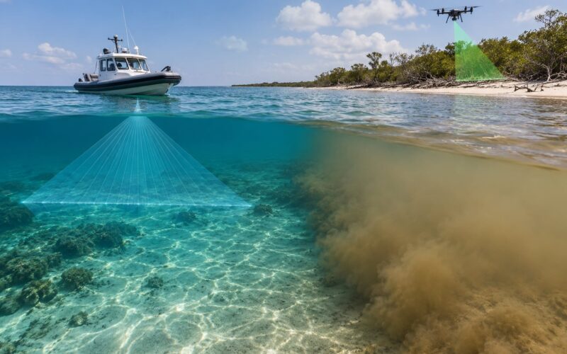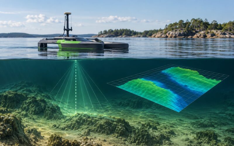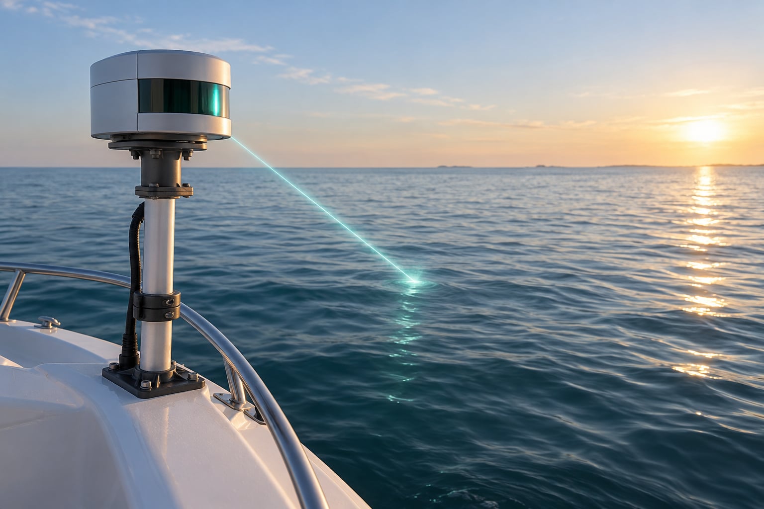
Lidar works on water by timing laser pulses that leave the sensor, reflect off a surface, and come back. Over water, the surface that answers first is usually the water itself, which is why a standard near-infrared LiDAR gives you a flat plane where the sea should be. A green marine wavelength passes through that surface, and the bottom return underneath becomes your depth measurement.
That single distinction explains most of the confusion people hit when they search for how lidar works on water. Two different things are going on: measuring the water surface, and measuring the seafloor beneath it. This guide covers both, plus mounting, weather effects, and the point where an echo sounder is the better tool.
Updated for 2026. Written for boat builders, surveyors and ocean-robot developers who need the physics, not the brochure.
Table of Contents
- How Lidar Works on Water
- What Does Marine Lidar Measure?
- How Water Surfaces Affect Lidar Signals
- Marine Lidar Wavelengths and Sensor Types
- How Lidar Differs from Radar and Sonar
- How to Mount and Use Lidar on a Boat
- How Weather and Water Clarity Change the Results
- What Is Lidar Used for on Boats and Ocean Robots?
- Frequently Asked Questions
- Conclusion
How Lidar Works on Water
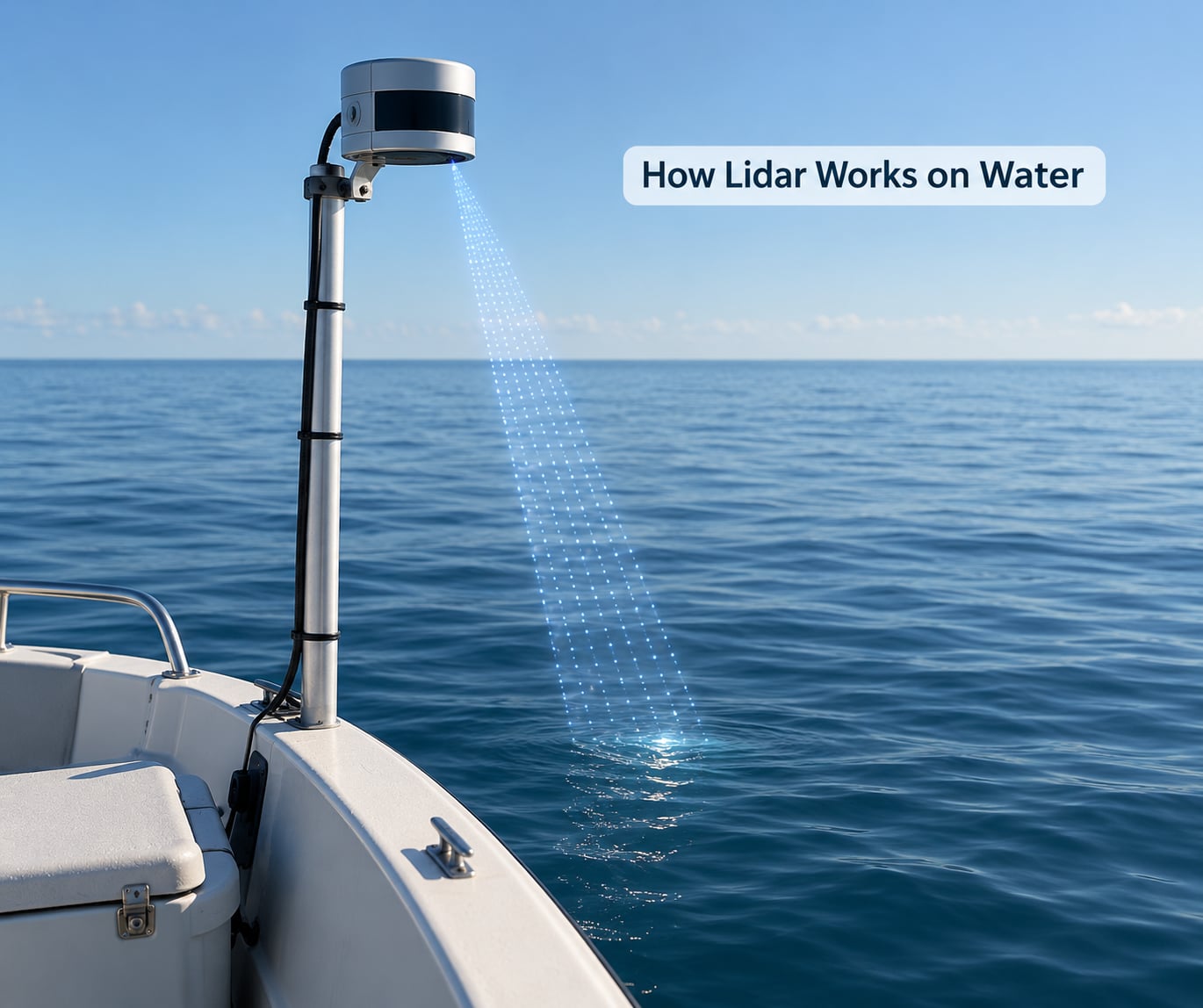
How lidar works on water, step by step
Lidar is Light Detection and Ranging. A laser fires a short pulse, a receiver waits for the light to come back, and the instrument divides the round-trip time by the speed of light to get a range. Half of that distance is the distance to whatever the pulse struck.
Over water, one pulse usually produces several returns. The surface reflects some light straight back. Some scatters off particles in the water column. Whatever is left travels to the bottom and comes back from there. The receiver records the shape of the return over time, which engineers call a waveform.
The workflow is short:
- Emit a laser pulse and start the timer.
- Record the surface return, the water column scatter and the bottom return.
- Classify the returns and keep the one that represents the bottom.
- Convert travel time to depth using the speed of light, then divide out the height of the sensor above the surface.
- Attach GNSS position and attitude from an IMU to each measurement.
- Store the result as a point in a point cloud, then build a surface from millions of points.
The classification step is where most field frustration lives. A naive threshold picks up everything, and the point cloud fills with a dense sheet of false points at sea level.
Why a standard 1064 nm LiDAR sees only a flat plane
Most terrestrial and airborne LiDAR uses a near-infrared laser around 1064 nm. Water absorbs that band very quickly, so the pulse dies within centimetres of the surface. The instrument measures the surface and stops.
What you get over open water is a flat sheet of returns at one elevation. It is not a broken measurement. It is a correct measurement of a mirror. The pulsing unit has no way to know the bottom exists.
Marine units add a green channel, usually around 532 nm, which travels through seawater far better. Many also carry the infrared channel at the same time so one instrument can map land and water in a single pass.
What Does Marine Lidar Measure?
What you can measure depends entirely on which band the sensor fires and where you point it. Here is the practical list.
- Range to a surface. The base output of every lidar: how far away the reflecting surface is. Useful for a hull-mounted unit spotting a jetty or a floating obstacle ahead.
- Water surface elevation. A near-infrared channel pointed at a calm surface gives a clean plane of water level. It is the reason standard LiDAR still flies over water during coastal mapping.
- Wave and swell structure. Scanning across a surface at high point density resolves individual wave heights, wave direction and the difference between short wind waves and long swell.
- Depth and bottom geometry. A green beam that reaches the bottom returns a second time, and the interval between surface and bottom return gives depth. Over a full survey that becomes a bathymetric surface.
- Shoreline and obstacle geometry. A boat-mounted unit angled forward profiles a pier, a jetty wall, a breakwater or a channel edge without putting anyone in the water.
- Atmospheric measurement. A separate class of marine lidar shoots upward or sideways into the air to measure aerosol layers, cloud height, marine boundary layer height and the depth of fog or haze over the sea.
A surface altitude, a bottom depth and an aerosol profile come from very different parts of the spectrum. If someone tells you what their “lidar” measures, ask which of those they mean.
How Water Surfaces Affect Lidar Signals
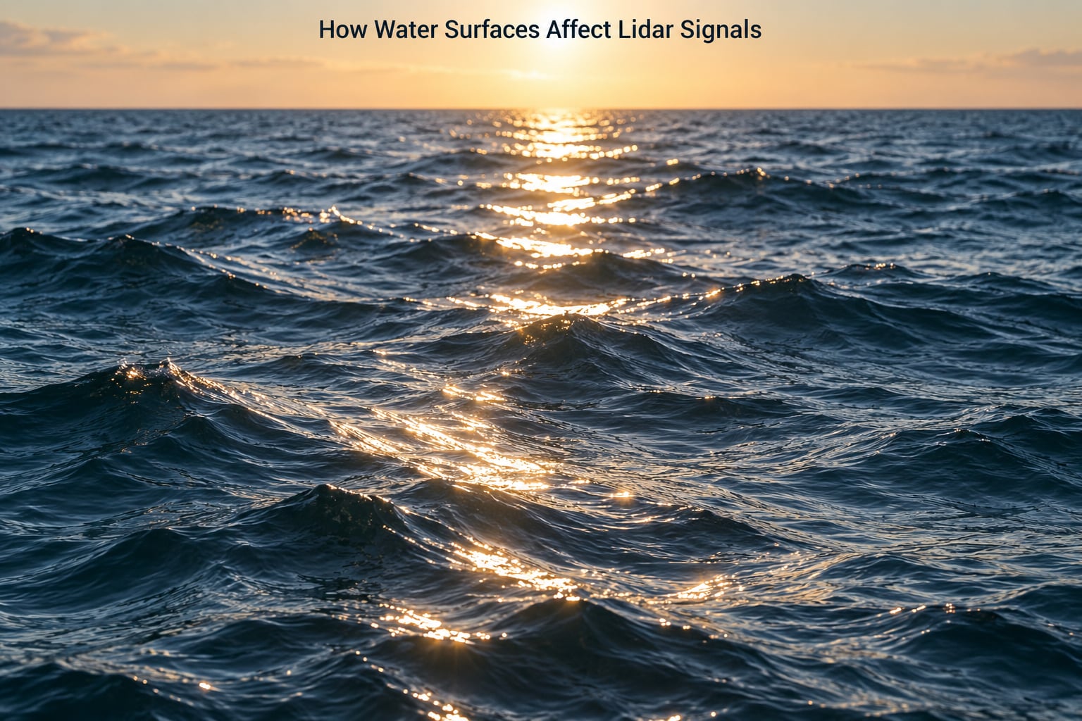
Water is a poor general reflector and a very good specular one, and that combination causes most signal loss over water.
On a flat calm surface, a pulse reflects almost perfectly mirror-like. Near the specular angle, the surface return is strong and the beam that would continue into the water carries little energy. The return is excellent, the bottom is invisible.
On a wind-roughened surface, the situation changes face by face. A slope facing the sensor sends energy back and the instrument gets a strong hit. A slope tilted away scatters that energy somewhere the receiver is not looking, and the return weakens. Point by point, a rough surface produces patchy returns that look like noise but are really geometry.
Other surface conditions push the same way:
- Foam and whitecaps scatter light in every direction and can produce returns at the wrong range.
- Suspended sediment and algae give strong backscatter from the water column, which buries the weaker bottom return behind it.
- Rain and spray put droplets directly in the beam path, adding false short-range returns along the flight line.
- Sun glitter adds background light to the receiver, which raises the noise floor and shortens the usable range.
This is why surveyors work near slack tide and low wind when they can. A flatter surface returns energy more predictably, and a smaller footprint concentrates what little energy reaches the bottom.
Marine Lidar Wavelengths and Sensor Types
Wavelength choice decides whether you see the surface or the bottom. Colour is shorthand for position in the spectrum, and the difference between the bands is not cosmetic.
| Wavelength | Band | Behaviour over water | Typical marine use |
|---|---|---|---|
| 532 nm | Green, visible | Partially absorbed by water; bottom returns detected in clear and moderately clear water | Bathymetric and topo-bathymetric depth mapping |
| 532 nm high energy | Green, visible | Same physics, more energy per pulse, so a weaker bottom signal still clears the noise | Deeper bottom returns, still bounded by eye-safety limits |
| 1064 nm | Near-infrared | Absorbed within centimetres of the surface | Water surface elevation, land topography |
| 905 nm | Near-infrared | Strong surface absorption, same behaviour as 1064 nm | Consumer and mapping LiDAR, surface returns over water |
| 532 nm plus 1064 nm | Dual channel | Surface and bottom in one pass, giving a seamless land-to-sea surface | Coastal and nearshore topographic plus bathymetric survey |
On top of colour sits a hard constraint: eye-safety limits. Because a laser that penetrates further needs more energy per pulse, and permitted pulse energy is capped for a given wavelength, sensors cannot simply be made more powerful. The usual trade is pulse energy against point density. More energy per pulse, fewer points per second. Higher point density, smaller footprints, weaker returns and shallower maximum depth.
Sensor geometry matters just as much. Linear or oscillating scanners sweep a line across the flight path. Rotating or hex scanners fan out a wider swath. Multi-look systems fire forward and backward so overlapping footprints increase the chance of catching a bottom return, which matters on rough or turbid water.
Platforms split the same way. Airborne units fly lines over a whole coast and cover a wide swath per pass, with water penetration limited by altitude and footprint spread. Shore-based units sweep from a fixed point, useful for a harbour approach. Boat and USV-mounted units put the sensor a few metres from the surface, which keeps the footprint small and the range short but gives very high point density where it matters.
How Lidar Differs from Radar and Sonar
Radar and sonar send out a wave and listen for the echo; lidar sends out light and listens for the flash. In air, radar wins on long range and bad weather. Underwater, only sound travels far, so sonar wins outright. Lidar’s advantage is resolution, and its weakness is that light does not survive water very well.
| Criterion | Lidar | Radar | Sonar |
|---|---|---|---|
| Signal | Light pulse | Radio wave | Acoustic pressure wave |
| Works above water | Yes, all weather except dense fog and heavy rain | Yes, in most conditions | No |
| Works underwater | Green band only, limited depth | No | Yes, this is its whole job |
| Useful range for a small craft | Short, tens of metres for obstacle work | Long, hundreds of metres or more | Short to medium for echo sounders |
| Best target | Surface shape, shallow bottom, fine obstacles | Vessels, buoys, coastlines in poor visibility | Depth, submerged objects, the water column |
| Weather sensitivity | Fog, rain, spray and turbidity all cut returns | Rain degrades but rarely stops it | Bubbles, silt and thermoclines distort readings |
| Output | Dense 3D point cloud | Range and speed | Depth profiles or a swath |
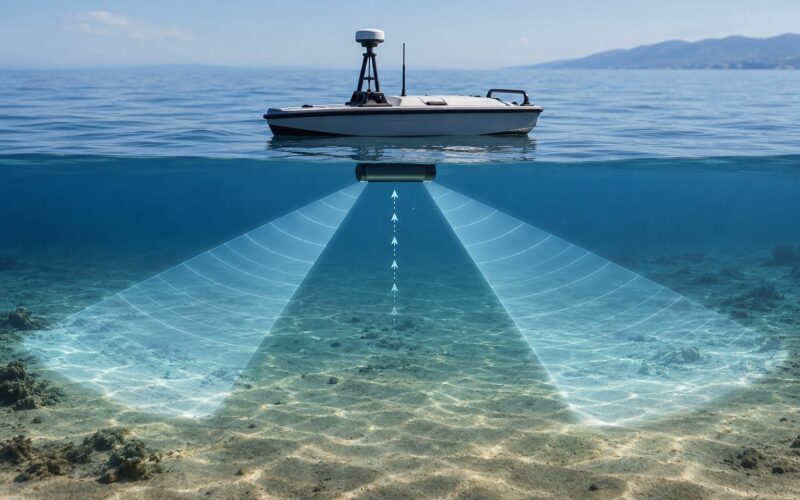
The practical split for a boat: lidar looks at the air and the top few metres of water, sonar measures depth. A multibeam sonar covers width as well as depth and is the standard tool for a full survey; a single beam echo sounder records a line down the track, which is enough for a dredge volume or a channel profile.
Surveyors commonly pair the two, taking lidar for the land and the shallow nearshore, and single beam or multibeam for anything deeper, then fusing both into one topo-bathymetric elevation model.
How to Mount and Use Lidar on a Boat
Mounting a lidar on a moving vessel is mostly a problem of geometry and vibration. Work through it in this order.
Pick the height and the aim
Height sets your footprint size. A beam spreads as it travels, so a sensor mounted two metres above the water produces a much smaller, brighter patch than one mounted twenty metres up. Higher also means the boat’s roll and pitch are a smaller fraction of the range, which smooths the data. The trade is coverage width, and small boats rarely have height to spare.
Keep the field of view clear
Nothing may sit in the cone between the sensor and the water: no mast, no radar arch, no flag, no crane cable, no spray rail. One blocking member is enough to produce a hard black stripe in the point cloud that looks exactly like a data error.
Protect the optics
Salt spray and dust attack the window fast. A wipers-and-heater setup, a freshwater rinse after every salt session, and a window in good condition are the cheapest reliability gains available. A scratched or fogged window cuts range and raises false returns at the same time.
Stabilize the mount
Small vessels pitch and roll hardest at rest, and a soft mount flexes with them. A rigid mount, ideally with a short moment arm to reduce pitch-induced error, is the fix. Record IMU data at the same time as the scan and post-process for motion, because no mechanical mount is good enough on a small hull in a chop.
Synchronize with position data
Every point needs a position, and a position needs a time. Log GNSS and IMU at full rate with time stamps aligned to the scan, and check the offset between the sensor and the antenna. Surveyors run check lines over a known feature at the start and end of a day; a repeat measurement on the same patch is the fastest way to catch a bad alignment.
Validate returns at the surface
Before trusting a depth, look at the raw returns. Expect a surface return first, a scatter region through the water column, then a bottom return. If the bottom return is weak, patchy or absent, the problem is usually water clarity or energy, not the instrument. Measure clarity with a Secchi disk before you blame the sensor: drop it until it disappears, note that depth, and repeat as you move. Log the Secchi readings with your survey; they turn a vague statement about water clarity into a number you can defend later.
How Weather and Water Clarity Change the Results
Water clarity does more damage to marine lidar than weather does, and it changes slowly enough that people miss it.
Turbidity is the scattering from suspended particles. A turbid column returns a thick band of scattered light that masks the bottom, and the usable depth collapses. A Secchi depth measurement is a cheap, honest proxy for this: roughly, useful bottom returns appear somewhere in the region between one and a few Secchi depths, depending on bottom type and sensor energy. Dark mud and seagrass reflect poorly and shorten that range, while pale sand reflects strongly and extends it.
Then there is the error nobody budgets for. Light bends as it passes between air and water and between layers of different density, and the beam travels a curved path rather than a straight one. The depth measurement stays reasonable, but the horizontal position of a deep return drifts further from where the instrument was pointing. The deeper the bottom and the rougher the surface, the worse this gets.
Weather adds its own losses:
- Fog and low cloud scatter the beam before it reaches the water, shortening range fast.
- Rain and spray put water droplets directly in the path and add noise near the sensor.
- Humidity and salt haze raise the background level in the receiver, which is the same as lowering your signal.
- Sun glitter off a rough surface does the same thing, and it is worst at low sun angles.
None of these are fatal. All of them should appear in the uncertainty budget rather than being discovered in the processed data.
What Is Lidar Used for on Boats and Ocean Robots?
Once you know what a marine pulse actually returns, the applications split into two groups: measuring the water, and measuring things floating or standing in it.
Wave and water-surface mapping
Airborne or drone-mounted green and infrared channels give wave height, period and direction across a wide area, which feeds coastal hazard and surf forecasting. Boats can do the same locally at very high density.
Shallow bathymetric surveys
Topo-bathymetric LiDAR maps beaches, nearshore bars, river corridors and reservoirs in one pass, giving a seamless surface from dry sand to shallow bottom. That continuity is the real reason to use it over separate land and boat surveys.
Shoreline, structure and obstacle detection
Angled forward, a boat-mounted unit profiles sea walls, piers, breakwaters and submerged structures. It suits repeated passes on a fixed line, such as checking a channel edge or the height of freeboard on a pontoon, without putting a person in the water.
Navigation and obstacle avoidance
Autonomous surface vessels use light-based depth cameras at short range for near-field obstacle avoidance, where fine detail and fast updates matter more than absolute depth. For anything beyond that, an echo sounder is the usual choice.
Atmospheric research over the ocean
Shipborne and airborne atmospheric lidar measures marine boundary layer height, aerosol and haze layers, and cloud base over the sea, which feeds weather models and coastal air quality work.
Environmental and habitat monitoring
Repeat surveys over the same lines produce difference models, so shoreline retreat, sediment movement and dredging volumes can be measured between passes. Paired with a Secchi depth record, the same survey data also documents water clarity change.
Frequently Asked Questions
Can lidar measure the height of ocean waves?
Yes, if the instrument has a channel that reflects off the water surface. A near-infrared channel pointed at the surface returns a dense set of points on the water itself, and processing those points gives wave height, period and direction. The measurement has nothing to do with the bottom. Rough water reduces the usable point density because tilted facets send energy away from the receiver.
What color laser is best for measuring water?
Green, around 532 nm. It sits at a point in the visible spectrum where seawater absorbs far more weakly than the near-infrared bands used by ordinary mapping lidar, so a green pulse can cross the surface and return from the bottom. Deeper water needs more energy per pulse for the same detector, and eye-safety limits cap how much energy a system may carry, which sets the real depth ceiling.
Is lidar better than radar for detecting objects on the water?
They answer different questions. Radar sees far through fog, rain and spray, which makes it the right tool for detecting vessels and coastlines at long range. Lidar gives far finer detail on a nearby surface or a shallow bottom, so it wins at short range in clear conditions. A small boat that must keep going in bad weather normally carries radar for detection and sonar for depth.
Does lidar work in fog and heavy rain?
It degrades. Fog droplets scatter the beam before it reaches the water, and rain adds backscatter close to the sensor, both of which raise the noise floor and shorten range. Radar is largely unaffected by the same conditions. If the task must continue in poor visibility, plan on radar for detection and keep lidar for the calm, clear stretches.
Can a regular lidar be mounted on a boat?
A standard near-infrared unit can be mounted, but over water it measures the surface and nothing below it. You would get a flat plane where the sea should be. To get depth you need a marine system with a green channel, or you pair a normal lidar for above-water geometry with a separate echo sounder for the water column.
What does a marine lidar point measure?
Each point is one range measurement: the travel time of a single pulse, converted to distance, plus a GNSS position and an IMU attitude. Several returns can come from one pulse, and the surface return, water column scatter and bottom return are separated in the recorded waveform. What survives classification is stored as one point, and millions of points become a point cloud and then a surface model.
Conclusion
How lidar works on water comes down to one fact: light from a near-infrared laser stops at the surface, and light from a green laser carries on to the bottom. Everything else follows from that, including the flat empty plane you get from a mapping unit over the sea and the patchy returns you get in turbid water.
Start by matching the instrument to the job. Note the water clarity with a Secchi disk, decide whether you actually need depth or only surface shape, and pick the platform that puts the sensor at the right height for your footprint. If the water is deep or murky, add an echo sounder rather than fighting the physics. If you want to work through fog and rain, radar is not optional.
Then validate on a short line before you commit to a survey, and keep the water column, refraction and tide in your uncertainty budget from day one.