Sonar wins underwater, lidar wins above the waterline and in clear shallows. Acoustic sonar measures depth at any depth and through silt, bubbles and rough surface; bathymetric lidar returns a denser point cloud over shallow, clear water and lets you carry one continuous elevation model from dry land into the channel. If you only pick one method, match it to your target and your water.
Most of the confusion around this topic comes from mixing up sensor families. Multibeam sonar and a bathymetric lidar are not competitors in the way two products compete for a shelf. They answer overlapping questions about the same seafloor, from different platforms, and each one fails in a place the other one holds up.
So this guide works through how each technology actually measures, how far each reaches, what happens when the water turns brown, what each one costs to mobilize, and when the sensible answer is to run both and merge the results into one topobathymetric surface.
Table of Contents
- Sonar vs Lidar for Water Mapping at a Glance
- How Sonar Measures Underwater Features
- How Lidar Measures Water and Shorelines
- Range, Accuracy, and Resolution Compared
- Sonar vs Lidar for Water Mapping: Water Clarity and Conditions
- Sonar vs Lidar for Mapping Seafloor, Objects, and Shorelines
- Hardware, Data Processing, and Cost Compared
- Which Should You Choose?
- Frequently Asked Questions
- Can lidar be used for underwater mapping?
- What is the best sensor for mapping the seafloor from a small boat?
- Is sonar better than lidar in murky or sediment-filled water?
- Does lidar measure water depth directly?
- Can sonar and lidar be used together on the same mapping system?
- Which technology is more suitable for an autonomous ocean robot?
- Conclusion
Sonar vs Lidar for Water Mapping at a Glance
The table below is the shortest useful summary. Every later section explains one row of it in more detail.
| Criterion | Sonar | Lidar |
|---|---|---|
| Measurement principle | Acoustic time-of-flight; a sound pulse echoes off the bottom | Optical time-of-flight; a laser pulse reflects off the bottom or water surface |
| Signal | Acoustic, roughly 1,500 m/s in seawater | Green laser near 532 nm for the bathymetric channel |
| Typical platform | Crewed survey boat, uncrewed surface vessel, mounted transducer | Fixed-wing aircraft, helicopter, UAV, boat-mounted shoreline unit |
| Practical depth | From a few metres to several hundred, with signal loss in very deep or soft mud | Usually a few multiples of the local Secchi depth, commonly to 30-50 m in favourable conditions |
| Water conditions | Works in murky, silty, bubbly or sediment-laden water | Fails when suspended sediment scatters the pulse before the bottom |
| Resolution | Cross-track cell size widens with depth unless the water column is compensated | Denser footprint, but ground cell size degrades with altitude and beam divergence |
| Coverage speed | Swath width sets the rate; wide arrays cover more per line | Very fast per line, but only over water it can actually reach |
| Land-to-water continuity | None; the transducer must be in the water | Topobathymetric systems map the beach, the surf line and the shallow bottom in one pass |
| Main cost driver | Vessel days, crew and multibeam hardware | Flight hours, sensor capital cost and airspace or permits |
| Where it struggles | Very deep soft sediment, bubble plumes, poor positioning over the water | Turbid water, dark absorbing bottoms, depths past the optical limit |
How Sonar Measures Underwater Features
Sonar is time-of-flight ranging with sound. A transducer fires a short pulse, listens for the echo, measures the two-way travel time, and multiplies it by the speed of sound in water to get a distance. Depth is the distance to the first strong return that is not the transducer or the water surface itself.
That works because sound travels roughly 1,500 m per second in seawater and the figure barely shifts with temperature or salinity. That stability is the whole reason sonar became the default depth instrument: you get a dependable number out of it, and the trade-off you pay is resolution rather than range.
Single-beam, multibeam, side-scan and forward-looking sonar
Single-beam sonar sends one beam straight down. It gives you a depth under the boat, which is all a simple sounder or a basic depth logger needs, and it is cheap and easy to interpret.
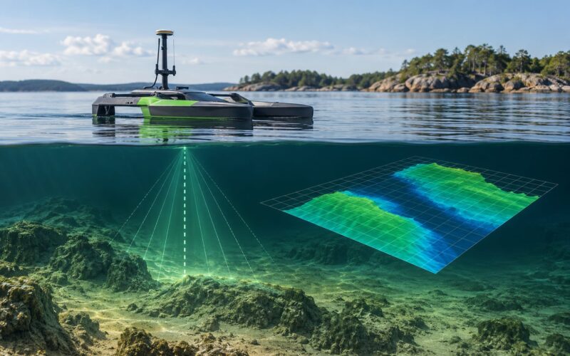
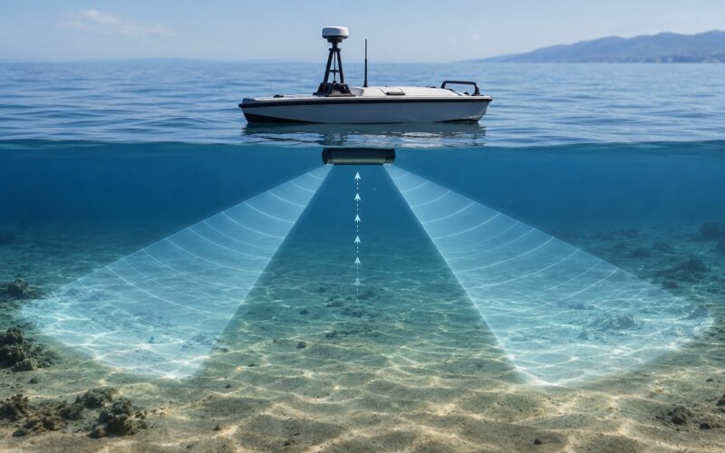
Multibeam echosounder sends dozens to hundreds of beams across a fan under the hull, measuring depth along each one at once. That turns a depth track into a surveyed strip, and with overlapping lines it becomes a bathymetric surface. Swath width is what drives survey speed, and the usual planning rule is that a vessel can survey efficiently out to roughly three to five times the water depth on a dual-head setup.
Side-scan sonar sends acoustic energy out to port and starboard rather than down. It builds a bright and dark pattern of return strength along the track, which is how wrecks, debris, pipelines and reef edges show up. It does not give you a calibrated depth, so it normally rides alongside multibeam data rather than replacing it.
Forward-looking sonar points beams ahead of the vessel to find hazards before the boat reaches them, and synthetic aperture sonar processes the boat’s own motion to create focused, high-resolution imagery for mine-like object detection and archaeology.
How Lidar Measures Water and Shorelines
Bathymetric lidar is time-of-flight ranging with light. A laser pulse leaves the sensor, part of it reflects off the water surface and part carries on to the seabed, and the instrument records both returns so it can separate the surface from the bottom.
What a green laser pulse does at the water surface
Water absorbs light, and it absorbs blue and green far more gently than red, which is why bathymetric systems fire into the green, near 532 nm, where photons survive the longest underwater trip. On the way down and back the pulse refracts at the surface, scatters off suspended particles, and attenuates until too few photons return to detect.
That gives the field rule practitioners actually use: useful depth is roughly two to three times the measured Secchi depth, and only when the bottom reflects light reasonably well. Sand and rock return well. Dark mud and seagrass can swallow the pulse. Where you see forty metres of visibility, treat forty as the floor and expect the deepest reliable returns around 80 to 120 m in the best case, with many shallow-water systems stopping short of that.
Airborne, boat-mounted and topobathymetric systems
Airborne bathymetric lidar hangs under a wing or rotor and sweeps shallow coastal water at survey-line speed, producing an exceptionally dense point cloud. Topobathymetric systems pair that green channel with a near-infrared channel that maps dry land, dunes and the surf zone in the same pass.
That continuity is the argument for lidar over a boat. One flight line can produce a single elevation model across the beach, the dune, the breaking surf, the bar and the inner channel, with no tide-gauge stitching error at the waterline. NOAA, USGS and Seabed 2030 programmes all lean on that land-to-water model for coastal flood risk and erosion work.
Boat-mounted shoreline lidar exists too: a green laser mounted on a small craft that sweeps across a river or harbour, useful where an aircraft cannot fly. Ordinary visible-light lidar cannot do this job. A red or near-infrared laser is absorbed within centimetres of the surface, so the depth you get is the depth of the water, not the shape of the bottom.
Range, Accuracy, and Resolution Compared
Range is where most published comparisons mislead, because both numbers depend on the site rather than the instrument. A depth figure quoted without the water clarity it was measured in is not a specification.
Why one range number never fits every site
For sonar, the governing limit is signal loss, and it arrives late. A hull-mounted multibeam array will sound hundreds of metres down in most conditions, and what usually stops it is a soft, gas-charged sediment layer or a poor satellite fix rather than the water itself. Slant range also means sound takes longer to get back from greater depth, so the energy budget tightens as depth grows.
For lidar, the governing limit is the water column itself. Three metres of turbid estuary water can defeat a system that maps fifty metres of tropical lagoon perfectly. Two Secchi readings on the same day, one inshore and one offshore, can mean completely different mobilization decisions.
Which one delivers better data in practice
Ask about vertical and horizontal accuracy separately. Vertical accuracy is what matters for chart depth and flood modelling, and it is where lidar looks best in shallow water: a shallow green-lidar return can carry centimetre-level vertical precision, helped by GPS/IMU direct georeferencing and low flight altitudes.
Sonar’s vertical accuracy depends on calibration discipline and how well the sound velocity profile is measured. A multibeam survey that meets IHO Order 1a is expected to hold roughly 0.5 m vertical and 1.0 m horizontal error at a specified depth, and Order 1b relaxes those figures modestly. In practice a well-calibrated survey in shallow, well-characterised water beats an uncalibrated one, and a badly calibrated multibeam survey can look worse than a decent lidar strip.
Resolution is where the two separate most. Sonar cell size grows with depth across the fan; at fifty metres depth a single beam footprint is already tens of centimetres wide. Lidar beams diverge too, so a lower altitude gives you a tighter footprint, but lidar starts from a much smaller footprint in the first place and delivers many more returns per square metre in the shallow zone it can reach.
Sonar vs Lidar for Water Mapping: Water Clarity and Conditions
Water clarity is not a footnote on a lidar survey. It is the go or no-go variable, and it decides which platform you mobilize and whether you will be flying the same lines twice.
Reading Secchi depth as a go or no-go signal
Drop a Secchi disc before you quote a survey, and record the bottom type while you are there. Clear water over pale sand means lidar will likely work to a predictable depth. Green-brown water over dark mud or dense seagrass means you should plan on sonar and treat any lidar as a bonus pass. If the site is seasonally variable, ask for readings in the dry season and the wet season, because the difference can decide the method.
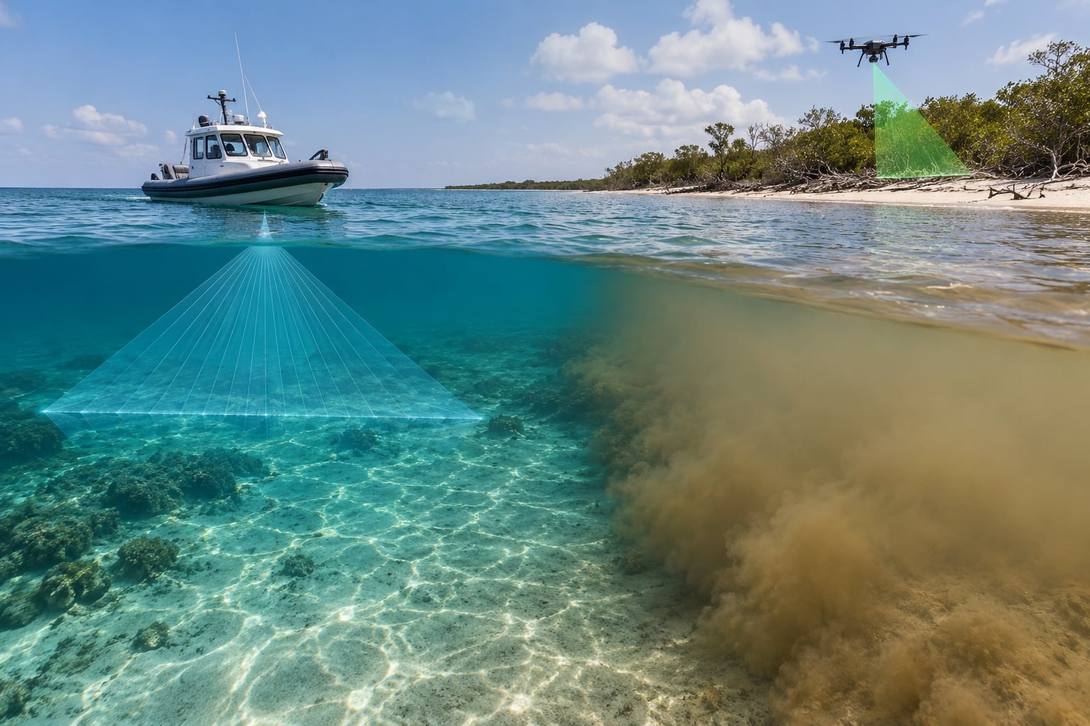
Murky water cuts lidar but barely touches sonar. Suspended sediment scatters the laser sideways, the return weakens, and the algorithm starts placing false bottoms in the water column, which shows up in the data as depth noise you have to clean out afterwards. Sound does the opposite: it travels through silt and suspended mud with little loss.
Waves, bubbles and surface reflection
Surface conditions push both technologies in different directions. For lidar, a rough surface scatters the reflected energy away from the sensor and rough wind-driven water can produce a surface return that masks the true surface position, which pushes error into the shallow water depths. Low flying over glassy water in clear conditions is the best-case scenario.
For sonar, waves mostly cause a positioning problem rather than a physics problem. Pitch, roll and heave move the transducer, and unless you have a high-quality heave compensator and inertial unit, that motion smears the bathymetry along track. Full bubble plumes from a passing vessel or an active outboard are worse than waves, because gas scatters sound as effectively as it scatters light.
Depth is also not the only thing in play. Strong current, drifting weed and a shifting sediment bed can make a multibeam survey disagree with itself between repeat lines, and neither sensor is immune to a moving target.
Sonar vs Lidar for Mapping Seafloor, Objects, and Shorelines
Once you match the sensor to the target, most of the argument dissolves. Use this table as a shortcut.
| What you are mapping | Use | Why |
|---|---|---|
| Open-coast bathymetry out to survey limits | Sonar | Depth alone defeats the laser; a vessel can work any depth the sound budget allows |
| Shallow bar, lagoon, reef flat, estuary | Lidar | Clear water plus a reflective sand or rock bottom gives dense, fast coverage |
| Beach, dune, surf zone, nearshore | Lidar | Topobathymetric systems carry the model across the waterline without stitching |
| Submerged obstacles, wrecks, debris | Side-scan or synthetic aperture sonar | Acoustic imagery finds objects that a depth sounder and a laser both miss |
| Submerged cable or pipeline route | Multibeam plus side-scan | Depth sets the clearance; imagery confirms the asset |
| Coral reef structure and habitat complexity | Both, in sequence | Lidar covers the reef flat broadly, multibeam and side-scan capture the 3D relief and the shadows |
| Suspended sediment and water column | Optical or acoustic backscatter, not depth sensors | Neither a multibeam nor a lidar depth return tells you the sediment load by itself |
| Deep channel and dredged approach | Sonar | Repeatable under-keel clearance at charting quality is a sonar job |
Hardware, Data Processing, and Cost Compared
The instrument is the cheap part of either survey. Mobilisation, calibration and processing usually decide which method is cheaper per square kilometre.
What each system needs on board or in the air
A multibeam survey needs a transducer with a clean, level mounting, a high-grade GNSS/IMU pair, a sound velocity probe at the transducer face, and enough water samples to build a sound velocity profile. On top of that come tide gauges, a heading reference, draft measurement, and a processing chain for tide reduction and error handling. Calibration takes a survey-grade ellipsoid check and a roll test before anyone is cleared to survey.
A lidar survey needs a stabilised platform, a GPS/IMU pair tight enough that every pulse inherits a good position, an aircraft or a boat with clear sightlines, and a flight plan with overlap high enough to merge lines. On a boat-mount shoreline unit, the same georeferencing logic applies but the calibration burden is far lighter.
Data volume tells you where the effort goes. Airborne lidar campaigns produce hundreds of billions of pulses, so processing means trajectory adjustment, noise removal and tiling, and in turbid conditions some flight lines get reflown because the returns do not meet the usable bottom threshold. Multibeam data is lighter, but it needs more operator judgement: line planning around swell direction, tide gating, and splitting the water column out before the depth sound.
Where the money actually sits
Cost per square kilometre is dominated by platform time, not sensor price. A crewed survey vessel is the most expensive asset per day but it can work any depth and any sea state a crew will accept. An uncrewed surface vessel removes the crew and the fuel bill and can run beyond the horizon with remote supervision, at the cost of weather windows you do not control.
Airborne lidar has no hull, no crew exposure and very high line rates, so it wins on shallow-water area covered per flying hour. It loses when you need depth, when airspace is restricted, or when turbidity sends you back to refly. For a small boat with a tight budget, a modest multibeam plus a sound velocity profile is often the more honest starting point.
Which Should You Choose?
Choose by the shortest of four things: how deep the water is, how clear it is, what the deliverable is, and what you can put in the water or in the air.
- Sonar, when depth runs past about 30-40 m or clarity is uncertain. This covers most offshore work, channel surveys and anything under keel clearance rules.
- Lidar, when the water is shallow and clear and you want speed plus a land-to-water model. Estuaries, reef flats, bar-and-beach systems, coastal flood modelling.
- Both, when the deliverable is one surface. Lidar for the shallows and the shoreline, multibeam for everything it cannot reach, then merge to a topobathymetric digital elevation model.
- Side-scan or synthetic aperture sonar, when the target is an object rather than a surface. These are companions to both, not substitutes.
Before you mobilize anything, run a five-point pre-survey check. Record the Secchi depth at a few points across the site and in the season you will survey. Note the bottom type, because dark mud and seagrass kill lidar returns even in clear water. Check the tidal window, since both methods need a tide correction and tidal streams push a small boat around. Confirm positioning quality, because a shallow creek or a canopy of trees will degrade your GNSS more than any sensor choice will. Then decide how many reflights you can absorb, and price the alternative sensor as your plan B.
One real programme shows what a mixed fleet buys you. The Florida Seafloor Mapping Initiative combined airborne topobathymetric lidar across roughly 27,000 square kilometres down to about 48 m depth with multibeam sonar coverage of roughly 18,000 square kilometres, plus more than 2,150 square kilometres from an uncrewed surface vessel, pushing coverage past 85 m depth in places. Turbidity forced some lines to be reflown, and the reported benefit was an annual return in the tens of millions. That is the honest shape of a hybrid campaign: each sensor covers what the other cannot.
Frequently Asked Questions
Can lidar be used for underwater mapping?
Yes, but only the bathymetric kind, and only under conditions. It fires green laser pulses near 532 nm, which penetrate water far better than red light, and records both the surface return and the seabed return. Practical depth runs at roughly two to three times the measured Secchi depth, so clear shallow water works and turbid water does not. Ordinary visible-light lidar cannot see the bottom at all.
What is the best sensor for mapping the seafloor from a small boat?
A multibeam echosounder. It goes deeper than any lidar system you could realistically mount on a small craft, keeps working in murky or bubbly water, and produces a proper bathymetric strip rather than a single depth under the hull. Add a sound velocity probe and a GNSS/IMU pair or the data will not hold up to survey standard. Lidar is the better second sensor for shallow, clear water near shore.
Is sonar better than lidar in murky or sediment-filled water?
Yes, decisively. Suspended sediment scatters a laser sideways and kills the bottom return before it can be detected, while acoustic sound travels through silt and mud with very little loss. In turbid estuaries or anywhere with a Secchi depth in single digits, sonar is usually the only workable option. Treat any lidar coverage there as a bonus pass rather than the plan, and expect reflights if you fly it anyway.
Does lidar measure water depth directly?
It measures it indirectly, and that distinction matters. A lidar system measures range by time of flight to whatever it reflects from. It records the water surface return and the seabed return separately, and depth comes from the difference between the two. Point it at clear water and it gives you the bottom; point a near-infrared instrument at murky water and it gives you nothing but the surface. That is why the wavelength and the water clarity decide the outcome.
Can sonar and lidar be used together on the same mapping system?
Yes, and most large programmes do exactly that. Lidar covers shallow, clear water and the shoreline; multibeam covers everything deeper or murkier; the two datasets are then merged into one topobathymetric digital elevation model with a common datum and a common tide correction. The Florida Seafloor Mapping Initiative paired roughly 27,000 square kilometres of airborne lidar with roughly 18,000 square kilometres of multibeam for that reason. The merge step, not the collection, is the hard part.
Which technology is more suitable for an autonomous ocean robot?
It depends on what the robot is doing. A surface vessel running long, repeat, shallow-water transects suits lidar if the water is clear enough for it to earn its flight time. Anything deeper, or any mission in variable water clarity, suits multibeam because it keeps returning a depth when the laser stops. Most small autonomous platforms go with multibeam for endurance and payload reasons, and treat lidar as a specialist payload for nearshore work.
Conclusion
Sonar vs lidar for water mapping comes down to five questions, in this order: what are you mapping, how deep is it, how clear is the water, what platform can you mobilize, and what accuracy does the deliverable demand. Answer those and the choice usually makes itself, because sonar reaches where the light runs out and lidar covers shallow clear water several times faster with a continuous land-to-water surface.
Start with a Secchi reading and a bottom-type check on the actual site. That single field visit resolves most of the argument before anyone books a boat or a flight line.