A geotag is location data — latitude, longitude and usually altitude — written into a photo’s EXIF metadata so the image records where it was taken. To geotag photos from a boat, you record the vessel’s position and time with a phone, an external GNSS receiver or a chartplotter log, then match each photo’s timestamp to that track so the coordinates land in the file.
Doing it from a boat adds three problems you never meet on land: there is usually no cell coverage offshore, the antenna may sit low where the sky is blocked, and the vessel keeps moving between shots. A tag that looks fine in a photo viewer can be hundreds of metres off, and the error is invisible until the data is on a map.
This guide walks through the whole job, from settings before you cast off to verifying tags at anchor, plus what to do when a camera has no GPS at all.
Table of Contents
- What You Need
- Step-by-Step: How to Geotag Photos from a Boat
- Common Mistakes
- Frequently Asked Questions
- Can I geotag photos from a boat without internet service?
- Do all cameras automatically save GPS coordinates in photos?
- How accurate should boat photo locations be for research documentation?
- Can I add a location to photos taken with a camera that has no GPS?
- Should I use latitude and longitude in decimal degrees or degrees and minutes?
- How do I keep GPS location data when editing or exporting photos?
- Conclusion
What You Need
Geotagging needs three things that work together: a position source, a clock, and somewhere to write the result. Most failures come from one of those three being quietly wrong.
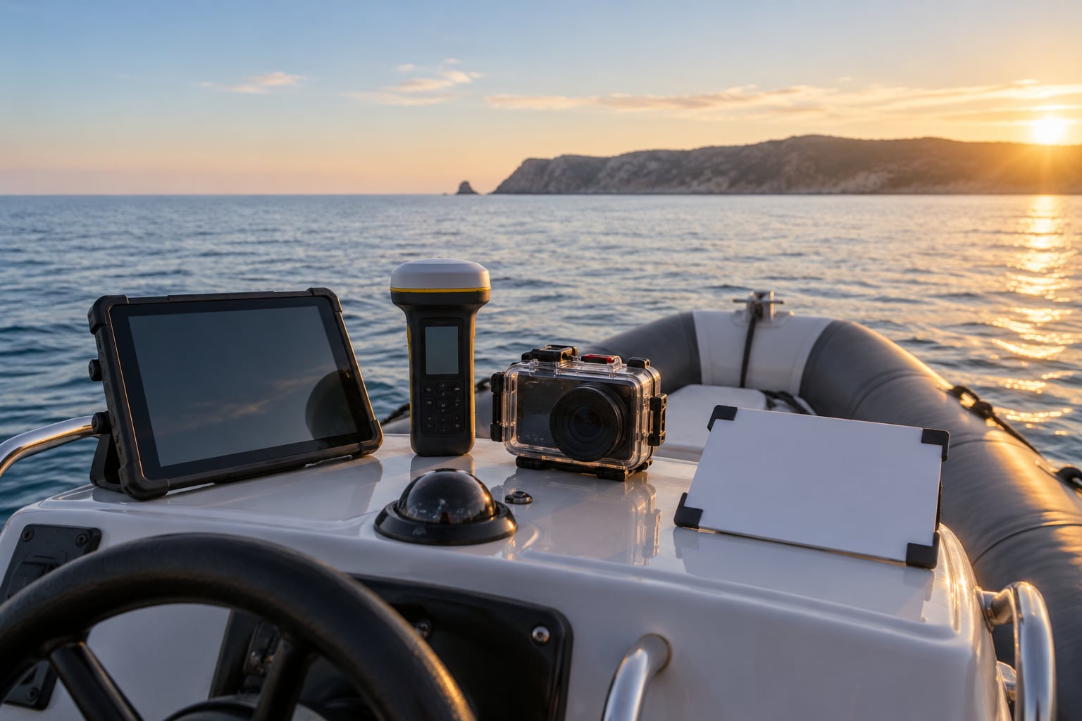
- Position source. A phone with location services enabled, an external GNSS receiver logging to GPX, a camera with built-in GPS, or an NMEA feed from a chartplotter. A multi-GNSS receiver that locks GPS, Galileo and GLONASS satellites together usually holds a tighter fix than a phone.
- Accurate time. The camera clock and the position log must agree. Syncing them at the dock is the single cheapest accuracy win in the whole process.
- Storage. Continuous logging fills a phone quickly. Clear space before departure and confirm your originals will back up without stripping metadata.
- Offline maps and charts. Download the area you are working in before you leave the dock. Navigation apps need a data connection to lay down chart tiles otherwise.
- Power. A charged battery plus a power bank or USB feed. Continuous logging at short intervals is the biggest battery draw of the trip.
- A reference note. A time-stamped start position written in your notebook, so you have a known anchor when you check the data later.
Record that reference position in one consistent format — decimal degrees is the safest — and use it everywhere. Mixing degrees and minutes with decimal degrees mid-trip is how coordinate typos end up in a dataset.
| Method | Typical accuracy | Battery cost | Setup | Best for |
|---|---|---|---|---|
| Phone app writing GPS at capture | 3-10 m open sky | High | Low | Quick shoots and small boats with a clear sky |
| Phone logging a GPX track, matched afterwards | 3-10 m, worse if the device falls back to network positioning | High | Low | Phone-only trips with no geotag option |
| Dedicated multi-GNSS receiver logging GPX | 2-5 m | Medium | Medium | All-day transects and repeatable work |
| Camera with built-in GPS | 3-8 m | High | Low | Tagging at the moment of capture |
| NMEA track from a chartplotter | 2-5 m with a good antenna | None added | High | Vessels that already log a track |
Accuracy figures assume GPS-only mode and an unobstructed antenna. Under a hard deck, inside a cabin or against a cliff, every one of these gets worse.
Step-by-Step: How to Geotag Photos from a Boat
Step 1: Prepare GPS, Storage, and Offline Maps
Turn on location services and set the device to GPS-only or GNSS-only rather than network-assisted. Network positioning is a crutch that buys a faster first fix, and on open water it is the reason a track can end up following a road along the shore instead of the water you actually sailed.
Set the time zone deliberately. The trick experienced users use is to leave the camera on home time so the offset to the track is always a known, reversible number. Then download offline chart areas and clear enough storage for a full day of logging.
You know this worked when the position icon shows a real fix rather than a triangle or a question mark, and the recorded time matches the time on a second device.
Step 2: Confirm Your Position at the Start of the Trip
At the dock, wait for a full fix with more than a handful of satellites and a low dilution of precision reading if your device shows one. Cold starts on a phone can take a couple of minutes.
Compare the phone reading against your chartplotter, your paper chart and any fixed marker you can see — a breakwater head, a mooring buoy, the harbour entrance light. Write down the time and the coordinates in your notebook.
A useful check: compare the phone with a chartplotter fed by a mast-top antenna. If they disagree by more than about 15 m while you are stationary, find out which one is using network positioning before you leave.
Success here looks like two independent devices agreeing within a few metres while the boat has not moved.
Step 3: Take Photos While Recording the Exact Position
Keep the track logging continuously for the whole trip. The key to geotag photos from a boat is that the log is the record, not the individual fix, so nothing depends on remembering to switch something on between shots.
Keep the phone or receiver where it can see the sky, mounted and clear of spray. A dry bag on the helm is fine for a phone with a view above the windscreen; a mast-top or arch-top antenna is better. Anything below a solid deck roof will degrade the fix badly.
Note movement when you shoot. If the boat drifts on a transect line or you circle a feature before photographing it, write down the direction of travel and whether the engine was running, because photos shot while manoeuvring are the ones that get tagged at a position the vessel only passed through.
Include a reference marker in some frames — a numbered station board, a buoy, a distinctive rock. It costs nothing and gives you a visual cross-check against the track later.
Step 4: Handle Cameras That Do Not Store GPS Data
Most mirrorless and DSLR bodies have no GPS, and no phone will geotag a file it did not shoot. The workaround is to log a track on a separate device and write the coordinates into the photos afterwards, matching them by timestamp.
To geotag photos from a boat this way, export the GPX track from your logger, then load it in post-processing software that reads both the track and the photo timestamps. Lightroom matches a track to a folder automatically through its GPS-based location assignment; Geosetter handles larger batches and manual dragging of individual points.
Before matching anything, check the time offset. Subtract the track time from the photo time for one image whose location you are certain of, and the difference is your offset. Applying that offset across the batch fixes what looks like a catastrophic tracking error but is usually a clock problem.
A second route is to mount a small GPS accessory in the camera’s hot shoe or remote port so coordinates are written at the shutter press. That removes post-processing entirely, at the cost of battery drain on the body and one more cable to keep dry.
Step 5: Verify and Export the Location Data
Do this before you leave the water, not weeks later. Pull up three to five tagged photos, note their times, and check those points against your track and against the chart. Any photo sitting inland while the boat stayed offshore is a problem you can still solve while the day is fresh.
Inspect the EXIF GPS fields directly rather than trusting a map pin. Look for the latitude, longitude, altitude and timestamp tags, and check whether a fix flag or accuracy figure is present. A tag with no fix information may have come from a network estimate rather than satellites.
Export the position information as a separate table or KML alongside the images if other people will use the data. Some editing programs drop unknown tags on save, so verify a file after export rather than assuming it survived.
One more check worth making: confirm your coordinates refer to the reference you think they do. Chart datum confusion is mostly a display issue, but mixing datum values between a chart and a GPS readout puts a boat tens of metres from where the chart says it is.
Step 6: Name and Back Up Geotagged Images
Build filenames that carry the information you would otherwise have to look up: date, time, station or waypoint, and the coordinates. A pattern like 2026-06-14_0942_st03_41.3621N-071.5047W.jpg sorts correctly, stays readable on any system, and survives being emailed to someone who never sees your track file.
Back up in two places before you delete anything from the card. Copy the originals with their metadata intact, and copy the GPX track alongside them — a tagged photo with no track behind it is much harder to audit.
If you plan to publish the images, strip or blur the GPS fields first on any set that shows nesting grounds, moorings, private property or research stations. Stripping is easy in most editors; protecting a location you do not want publicised is harder after the fact.
Common Mistakes
Most bad boat geotags come from one of eight things. Here is what goes wrong and the fix.
- Weak or blocked GPS signal. A phone below a deck roof or in a cabin reports a position with no satellites behind it. Fix: mount the receiver or phone where the sky is visible, and check the satellite count before trusting a reading.
- Stale fixes. The app shows a position but has not updated it since you docked. Fix: look at the fix age or timestamp, not just the coordinates.
- Camera clock out of sync. Photos land at the right general place but hours off, so the track matches the wrong part of the trip. Fix: sync clocks before departure and verify one known photo.
- Network positioning taking over. A river trip logged along a road hundreds of metres away is the classic symptom, seen when a device falls back to cell towers along the shore. Fix: force GPS-only or GNSS-only mode.
- Logging interval too long. A five-minute interval between fixes straight-lines the track, so it cuts corners and can place a photo on land during a turn. Fix: one to two minutes while manoeuvring, up to five on a straight run.
- Antenna placed badly. Salt spray, a metal rail or a cabin roof degrade the signal. Fix: run the antenna as high and clear as the boat allows, and keep it dry.
- Confusing chart datum with GPS coordinates. Fix: state the datum with any position you publish, and compare readings from one source only.
- Metadata lost on export. Converting, resizing or editing through a tool that does not preserve EXIF silently removes the coordinates. Fix: verify one exported file, and keep an untouched master copy.
- Assuming every photo was taken at the last plotted position. Fix: work from timestamps, not from where the boat happened to be when you looked at the screen.
One habit prevents most of this: at anchor, spot-check a few tags against the track before you pack up. It takes five minutes and saves an afternoon of manual corrections.
Frequently Asked Questions
Can I geotag photos from a boat without internet service?
Yes, and offshore it is the normal case. Geotagging depends on satellite positioning and file timestamps, not on mobile data or Wi-Fi. You do need internet later, or never, if you write coordinates into the EXIF on the camera or match a GPX track on your own computer. Only the map tiles need a connection, so download offline charts before you leave the dock.
Do all cameras automatically save GPS coordinates in photos?
No. Most mirrorless and DSLR cameras have no GPS receiver built in, and no phone app can geotag a file it did not photograph. Only some compact cameras and phones write location at capture. For everything else you log a track on a separate device and write the coordinates into the photos afterwards by matching timestamps.
How accurate should boat photo locations be for research documentation?
For habitat and species records, aim for 5 m or better and state that figure in your methods. Engineering or navigation work needs tighter accuracy and usually a receiver with differential corrections. Anything looser than about 10 m is fine for a photo map of an anchorage or a coastline. Record the accuracy estimate with the data, because an unlabelled coordinate cannot be judged later.
Can I add a location to photos taken with a camera that has no GPS?
Yes, that is the standard workaround. Log a GPX track on a phone or external receiver while you sail, then load the track into Lightroom or a dedicated tool such as Geosetter. The software matches each photo’s timestamp to the nearest recorded position and writes latitude, longitude and altitude into the file. Expect to correct the time offset before you start.
Should I use latitude and longitude in decimal degrees or degrees and minutes?
Store decimal degrees, such as 41.3621 and -71.5047, because every GPS device, mapping app and spreadsheet handles them without ambiguity. Degrees and minutes are fine for reading off a chart or writing in a notebook, as long as you convert consistently. Pick one format for filenames and metadata and never mix the two in the same dataset.
How do I keep GPS location data when editing or exporting photos?
Edit copies, never the originals, and check that your editor preserves EXIF fields on save. Some converters and social platforms strip location data silently, so open one exported file and confirm the GPS tags survived before you rely on the set. Keep a master backup with full metadata alongside any stripped copies you plan to publish.
Conclusion
Start with the dock work, not the water. Confirm location services are on and forced to GNSS-only, sync the camera clock to your logger, download offline charts and clear storage, then write down one reference position with its time.
From there the job is straightforward: log continuously, keep the antenna in open sky, and spot-check a few tagged photos at anchor before you leave. That five-minute check is what separates a usable survey record from a weekend spent dragging points around a map.